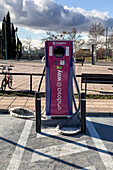
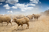
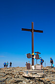
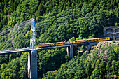
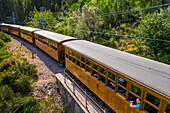
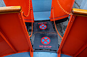
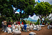
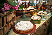
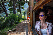
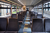
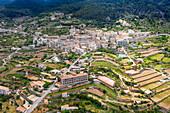
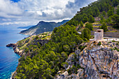
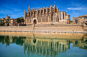
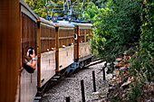
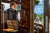
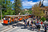
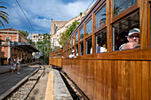
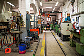
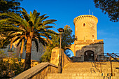
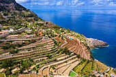
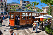
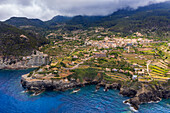
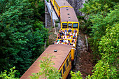
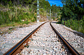
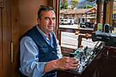
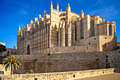
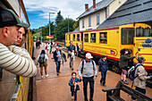
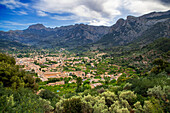
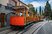
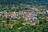
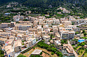
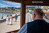
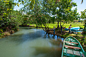
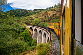
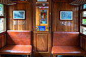
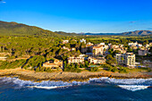
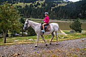
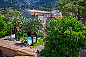
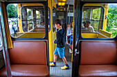
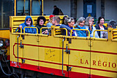
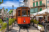
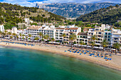
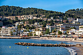
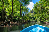
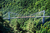
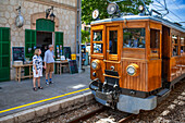
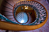
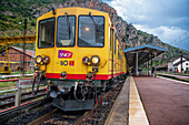
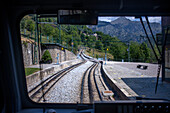
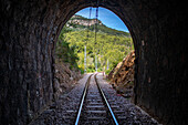
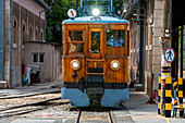
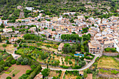
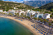
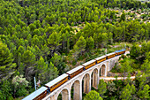
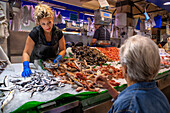
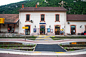
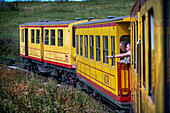
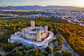
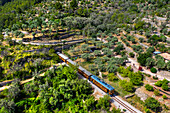
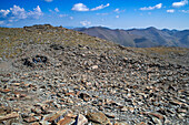
Images

Écologique Photos ❘ lookphotos

Room in a bungalow of Eco-lodge Hara Oasis on the banks of the River Draa in the large palm grove in Agdz at the foot of Djebel Kissane, Mount Kissane (Jbel Kissane), Draa-Tafilet region, Morocco, North West Africa
71483547 - Room in a bungalow of Eco-lodge Hara Oasis on the banks of the River Draa in the large palm grove in Agdz at the foot of Djebel Kissane, Mount Kissane (Jbel Kissane), Draa-Tafilet region, Morocco, North West Africa
Tudanca cows with grey coats peacefully graze in the lush pastures of Pechon, Cantabria, showcasing their unique curved horns.
14623998 - Tudanca cows with grey coats peacefully graze in the lush pastures of Pechon, Cantabria, showcasing their unique curved horns.
A container for recycling & a rubbish bin in the Convent of San Francisco, now a museum in Quito, Ecuador.
14623891 - A container for recycling & a rubbish bin in the Convent of San Francisco, now a museum in Quito, Ecuador.
A bright yellow granary is surrounded by flooded rice fields after harvest in Isla Mayor, Seville, showcasing the beauty of this landscape.
14623882 - A bright yellow granary is surrounded by flooded rice fields after harvest in Isla Mayor, Seville, showcasing the beauty of this landscape.
A solitary mountain refuge stands on a vast landscape in Los Campos de Hernán Pelea, offering a peaceful retreat in Andalusia.
14622337 - A solitary mountain refuge stands on a vast landscape in Los Campos de Hernán Pelea, offering a peaceful retreat in Andalusia.
Colibrí Paramuno, Shining Sunbeam, Aglaeactis cupripennis
14482618 - Colibrí Paramuno, Shining Sunbeam, Aglaeactis cupripennis
Espeletia santanderensis. .
14482602 - Espeletia santanderensis. .
The Páramo del Almorzadero, located in the Eastern mountain range of the Colombian Andes, between the departments of Santander and Norte de Santander, is a vital high mountain ecosystem for the region. With altitudes that exceed 4,300 meters, this páramo is home to a unique biodiversity, highlighting the frailejones, mosses and lichens adapted to the extreme cold and frequent fogs. Its numerous lagoons and wetlands are the source of important rivers that supply water to local communities and agricultural activities. In addition, it is a refuge for species such as the Andean condor and endemic
14482375 - The Páramo del Almorzadero, located in the Eastern mountain range of the Colombian Andes, between the departments of Santander and Norte de Santander, is a vital high mountain ecosystem for the region. With altitudes that exceed 4,300 meters, this páramo is home to a unique biodiversity, highlighting the frailejones, mosses and lichens adapted to the extreme cold and frequent fogs. Its numerous lagoons and wetlands are the source of important rivers that supply water to local communities and agricultural activities. In addition, it is a refuge for species such as the Andean condor and endemic
The municipality of Santo Domingo de Silos is located in the department of Norte de Santander, in the northeast of Colombia. Geographically, it is located in the Eastern Andes mountain range, at an altitude of approximately 2,850 meters above sea level. It borders municipalities such as Pamplona, ??Chitagá, Mutiscua and Cácota, in an area characterized by mountainous landscapes, moorlands and agricultural activities. It is part of the Santurbán Páramo, a water source for Santander and Norte de Santander.
14482367 - The municipality of Santo Domingo de Silos is located in the department of Norte de Santander, in the northeast of Colombia. Geographically, it is located in the Eastern Andes mountain range, at an altitude of approximately 2,850 meters above sea level. It borders municipalities such as Pamplona, ??Chitagá, Mutiscua and Cácota, in an area characterized by mountainous landscapes, moorlands and agricultural activities. It is part of the Santurbán Páramo, a water source for Santander and Norte de Santander.
The Páramo del Almorzadero, located in the Eastern mountain range of the Colombian Andes, between the departments of Santander and Norte de Santander, is a vital high mountain ecosystem for the region. With altitudes that exceed 4,300 meters, this páramo is home to a unique biodiversity, highlighting the frailejones, mosses and lichens adapted to the extreme cold and frequent fogs. Its numerous lagoons and wetlands are the source of important rivers that supply water to local communities and agricultural activities. In addition, it is a refuge for species such as the Andean condor and endemic
14482202 - The Páramo del Almorzadero, located in the Eastern mountain range of the Colombian Andes, between the departments of Santander and Norte de Santander, is a vital high mountain ecosystem for the region. With altitudes that exceed 4,300 meters, this páramo is home to a unique biodiversity, highlighting the frailejones, mosses and lichens adapted to the extreme cold and frequent fogs. Its numerous lagoons and wetlands are the source of important rivers that supply water to local communities and agricultural activities. In addition, it is a refuge for species such as the Andean condor and endemic
Cycleway. Avenida el Poblado.
14482010 - Cycleway. Avenida el Poblado.
The Lagunas Negras Trail, located in the municipality of Vetas, Santander, is a hiking route located in the Páramo de Santurbán. It is a route with high mountain landscapes, characterized by impressive rock formations and lagoons of glacial origin with the presence of fauna and flora subject to conservation, among them is the endemic species of frailejon, Espeletia santanderensis.
14481879 - The Lagunas Negras Trail, located in the municipality of Vetas, Santander, is a hiking route located in the Páramo de Santurbán. It is a route with high mountain landscapes, characterized by impressive rock formations and lagoons of glacial origin with the presence of fauna and flora subject to conservation, among them is the endemic species of frailejon, Espeletia santanderensis.
Cácota is a municipality located in the department of Norte de Santander, in the northeastern region of Colombia. With a rich history dating back to colonial times, this place has kept alive traditions that reflect the fusion between indigenous roots and Spanish heritage. Its natural environment, characterised by landscapes that combine agricultural areas and areas of native vegetation. The architecture of its buildings shows a deep cultural legacy.
14481787 - Cácota is a municipality located in the department of Norte de Santander, in the northeastern region of Colombia. With a rich history dating back to colonial times, this place has kept alive traditions that reflect the fusion between indigenous roots and Spanish heritage. Its natural environment, characterised by landscapes that combine agricultural areas and areas of native vegetation. The architecture of its buildings shows a deep cultural legacy.
Peasants starting their work day.
14481771 - Peasants starting their work day.
The municipality of Santo Domingo de Silos is located in the department of Norte de Santander, in the northeast of Colombia. Geographically, it is located in the Eastern Andes mountain range, at an altitude of approximately 2,850 meters above sea level. It borders municipalities such as Pamplona, ??Chitagá, Mutiscua and Cácota, in an area characterized by mountainous landscapes, moorlands and agricultural activities. It is part of the Santurbán Páramo, a water source for Santander and Norte de Santander.
14481651 - The municipality of Santo Domingo de Silos is located in the department of Norte de Santander, in the northeast of Colombia. Geographically, it is located in the Eastern Andes mountain range, at an altitude of approximately 2,850 meters above sea level. It borders municipalities such as Pamplona, ??Chitagá, Mutiscua and Cácota, in an area characterized by mountainous landscapes, moorlands and agricultural activities. It is part of the Santurbán Páramo, a water source for Santander and Norte de Santander.
Barrio Laureles. Avenida Jardin, Segundo Parque de Laureles .
14481628 - Barrio Laureles. Avenida Jardin, Segundo Parque de Laureles .
Espeletia santanderensis. .
14481456 - Espeletia santanderensis. .
The municipality of Chitaga is located in the department of Norte de Santander, in the northeast of Colombia. Geographically, it is located in the Andean region, at an altitude of 2,300 meters above sea level, within the high plateau of the Eastern Andes mountain range. It borders municipalities such as Pamplona, ??Silos and Cácota, and is part of an area characterized by mooslands and rural areas dedicated to agriculture and livestock. It is part of the Paramo de Santurbán, a water source for Santander and Norte de Santander.
14481395 - The municipality of Chitaga is located in the department of Norte de Santander, in the northeast of Colombia. Geographically, it is located in the Andean region, at an altitude of 2,300 meters above sea level, within the high plateau of the Eastern Andes mountain range. It borders municipalities such as Pamplona, ??Silos and Cácota, and is part of an area characterized by mooslands and rural areas dedicated to agriculture and livestock. It is part of the Paramo de Santurbán, a water source for Santander and Norte de Santander.
Parroquia San Juan Nepomuceno.
14481257 - Parroquia San Juan Nepomuceno.
Espeletia santanderensis. .
14481101 - Espeletia santanderensis. .
The Lagunas Negras Trail, located in the municipality of Vetas, Santander, is a hiking route located in the Páramo de Santurbán. It is a route with high mountain landscapes, characterized by impressive rock formations and lagoons of glacial origin with the presence of fauna and flora subject to conservation, among them is the endemic species of frailejon, Espeletia santanderensis.
14481078 - The Lagunas Negras Trail, located in the municipality of Vetas, Santander, is a hiking route located in the Páramo de Santurbán. It is a route with high mountain landscapes, characterized by impressive rock formations and lagoons of glacial origin with the presence of fauna and flora subject to conservation, among them is the endemic species of frailejon, Espeletia santanderensis.
Barrio Laureles, Segundo Parque, carrera 76.
14480911 - Barrio Laureles, Segundo Parque, carrera 76.
The Lagunas Negras Trail, located in the municipality of Vetas, Santander, is a hiking route located in the Páramo de Santurbán. It is a route with high mountain landscapes, characterized by impressive rock formations and lagoons of glacial origin with the presence of fauna and flora subject to conservation, among them is the endemic species of frailejon, Espeletia santanderensis.
14480833 - The Lagunas Negras Trail, located in the municipality of Vetas, Santander, is a hiking route located in the Páramo de Santurbán. It is a route with high mountain landscapes, characterized by impressive rock formations and lagoons of glacial origin with the presence of fauna and flora subject to conservation, among them is the endemic species of frailejon, Espeletia santanderensis.
The municipality of Santo Domingo de Silos is located in the department of Norte de Santander, in the northeast of Colombia. Geographically, it is located in the Eastern Andes mountain range, at an altitude of approximately 2,850 meters above sea level. It borders municipalities such as Pamplona, ??Chitagá, Mutiscua and Cácota, in an area characterized by mountainous landscapes, moorlands and agricultural activities. It is part of the Santurbán Páramo, a water source for Santander and Norte de Santander.
14480832 - The municipality of Santo Domingo de Silos is located in the department of Norte de Santander, in the northeast of Colombia. Geographically, it is located in the Eastern Andes mountain range, at an altitude of approximately 2,850 meters above sea level. It borders municipalities such as Pamplona, ??Chitagá, Mutiscua and Cácota, in an area characterized by mountainous landscapes, moorlands and agricultural activities. It is part of the Santurbán Páramo, a water source for Santander and Norte de Santander.
The Páramo del Almorzadero, located in the Eastern mountain range of the Colombian Andes, between the departments of Santander and Norte de Santander, is a vital high mountain ecosystem for the region. With altitudes that exceed 4,300 meters, this páramo is home to a unique biodiversity, highlighting the frailejones, mosses and lichens adapted to the extreme cold and frequent fogs. Its numerous lagoons and wetlands are the source of important rivers that supply water to local communities and agricultural activities. In addition, it is a refuge for species such as the Andean condor and endemic
14480816 - The Páramo del Almorzadero, located in the Eastern mountain range of the Colombian Andes, between the departments of Santander and Norte de Santander, is a vital high mountain ecosystem for the region. With altitudes that exceed 4,300 meters, this páramo is home to a unique biodiversity, highlighting the frailejones, mosses and lichens adapted to the extreme cold and frequent fogs. Its numerous lagoons and wetlands are the source of important rivers that supply water to local communities and agricultural activities. In addition, it is a refuge for species such as the Andean condor and endemic
The Lagunas Negras Trail, located in the municipality of Vetas, Santander, is a hiking route located in the Páramo de Santurbán. It is a route with high mountain landscapes, characterized by impressive rock formations and lagoons of glacial origin with the presence of fauna and flora subject to conservation, among them is the endemic species of frailejon, Espeletia santanderensis.
14480811 - The Lagunas Negras Trail, located in the municipality of Vetas, Santander, is a hiking route located in the Páramo de Santurbán. It is a route with high mountain landscapes, characterized by impressive rock formations and lagoons of glacial origin with the presence of fauna and flora subject to conservation, among them is the endemic species of frailejon, Espeletia santanderensis.
Espeletia santanderensis. .
14480762 - Espeletia santanderensis. .
Medellin downtown. Avenida Oriental.
14480603 - Medellin downtown. Avenida Oriental.
Frailejon. The Laguna de Cacota or Laguna del Cacique is surrounded by lush moorland vegetation, characterized by frailejones, native plants adapted to cold and humid conditions. Not only does this landscape offer a breathtaking view, but it also provides habitat for a variety of flora and fauna species adapted to these mountain ecosystems.
14480164 - Frailejon. The Laguna de Cacota or Laguna del Cacique is surrounded by lush moorland vegetation, characterized by frailejones, native plants adapted to cold and humid conditions. Not only does this landscape offer a breathtaking view, but it also provides habitat for a variety of flora and fauna species adapted to these mountain ecosystems.
The municipality of Chitaga is located in the department of Norte de Santander, in the northeast of Colombia. Geographically, it is located in the Andean region, at an altitude of 2,300 meters above sea level, within the high plateau of the Eastern Andes mountain range. It borders municipalities such as Pamplona, ??Silos and Cácota, and is part of an area characterized by mooslands and rural areas dedicated to agriculture and livestock. It is part of the Paramo de Santurbán, a water source for Santander and Norte de Santander.
14480046 - The municipality of Chitaga is located in the department of Norte de Santander, in the northeast of Colombia. Geographically, it is located in the Andean region, at an altitude of 2,300 meters above sea level, within the high plateau of the Eastern Andes mountain range. It borders municipalities such as Pamplona, ??Silos and Cácota, and is part of an area characterized by mooslands and rural areas dedicated to agriculture and livestock. It is part of the Paramo de Santurbán, a water source for Santander and Norte de Santander.
The municipality of Chitaga is located in the department of Norte de Santander, in the northeast of Colombia. Geographically, it is located in the Andean region, at an altitude of 2,300 meters above sea level, within the high plateau of the Eastern Andes mountain range. It borders municipalities such as Pamplona, ??Silos and Cácota, and is part of an area characterized by mooslands and rural areas dedicated to agriculture and livestock. It is part of the Paramo de Santurbán, a water source for Santander and Norte de Santander.
14480008 - The municipality of Chitaga is located in the department of Norte de Santander, in the northeast of Colombia. Geographically, it is located in the Andean region, at an altitude of 2,300 meters above sea level, within the high plateau of the Eastern Andes mountain range. It borders municipalities such as Pamplona, ??Silos and Cácota, and is part of an area characterized by mooslands and rural areas dedicated to agriculture and livestock. It is part of the Paramo de Santurbán, a water source for Santander and Norte de Santander.
Cycleway. Avenida el Poblado.
14479989 - Cycleway. Avenida el Poblado.
The Lagunas Negras Trail, located in the municipality of Vetas, Santander, is a hiking route located in the Páramo de Santurbán. It is a route with high mountain landscapes, characterized by impressive rock formations and lagoons of glacial origin with the presence of fauna and flora subject to conservation, among them is the endemic species of frailejon, Espeletia santanderensis.
14479860 - The Lagunas Negras Trail, located in the municipality of Vetas, Santander, is a hiking route located in the Páramo de Santurbán. It is a route with high mountain landscapes, characterized by impressive rock formations and lagoons of glacial origin with the presence of fauna and flora subject to conservation, among them is the endemic species of frailejon, Espeletia santanderensis.
Barrio Laureles, Segundo Parque, carrera 76.
14479611 - Barrio Laureles, Segundo Parque, carrera 76.
Santuario de Nuestra Señora de los Dolores.
14479397 - Santuario de Nuestra Señora de los Dolores.
The Lagunas Negras Trail, located in the municipality of Vetas, Santander, is a hiking route located in the Páramo de Santurbán. It is a route with high mountain landscapes, characterized by impressive rock formations and lagoons of glacial origin with the presence of fauna and flora subject to conservation, among them is the endemic species of frailejon, Espeletia santanderensis.
14479240 - The Lagunas Negras Trail, located in the municipality of Vetas, Santander, is a hiking route located in the Páramo de Santurbán. It is a route with high mountain landscapes, characterized by impressive rock formations and lagoons of glacial origin with the presence of fauna and flora subject to conservation, among them is the endemic species of frailejon, Espeletia santanderensis.
Cácota is a municipality located in the department of Norte de Santander, in the northeastern region of Colombia. With a rich history dating back to colonial times, this place has kept alive traditions that reflect the fusion between indigenous roots and Spanish heritage. Its natural environment, characterised by landscapes that combine agricultural areas and areas of native vegetation. The architecture of its buildings shows a deep cultural legacy.
14479198 - Cácota is a municipality located in the department of Norte de Santander, in the northeastern region of Colombia. With a rich history dating back to colonial times, this place has kept alive traditions that reflect the fusion between indigenous roots and Spanish heritage. Its natural environment, characterised by landscapes that combine agricultural areas and areas of native vegetation. The architecture of its buildings shows a deep cultural legacy.
Tungudalur waterfall, Isafjordur, the largest settlement in the West Fjords. Iceland, West Fjords (Westfjords). Bunárfoss is a waterfall situated on the slopes along the beautiful Tungudalur valley, and it's Bunárfoss that truly enhances the beauty of Tungudalur valley. Blue Alaskan lupins (lupinus nootkatensis) cover vast swathes of Iceland.
14479069 - Tungudalur waterfall, Isafjordur, the largest settlement in the West Fjords. Iceland, West Fjords (Westfjords). Bunárfoss is a waterfall situated on the slopes along the beautiful Tungudalur valley, and it's Bunárfoss that truly enhances the beauty of Tungudalur valley. Blue Alaskan lupins (lupinus nootkatensis) cover vast swathes of Iceland.
SH Vega cruise is an expedition cruise ship operated by Swan Hellenic, near Dynjandi waterfall at the west fjords of Iceland.
14478429 - SH Vega cruise is an expedition cruise ship operated by Swan Hellenic, near Dynjandi waterfall at the west fjords of Iceland.
Eldfell lava field, town of Vestmannaeyjar, Heimaey, Westman Islands, south Iceland or Suðurland, Iceland. Lava sand and Blue Alaskan lupine (lupinus nootkatensis)
14478428 - Eldfell lava field, town of Vestmannaeyjar, Heimaey, Westman Islands, south Iceland or Suðurland, Iceland. Lava sand and Blue Alaskan lupine (lupinus nootkatensis)
Viking wax museum, Herjólfsdalur
14478412 - Viking wax museum, Herjólfsdalur
Recent rains transform Brazo de la Torre, turning the wetlands of Doñana into a vibrant landscape reflecting clouds and water.
14478250 - Recent rains transform Brazo de la Torre, turning the wetlands of Doñana into a vibrant landscape reflecting clouds and water.
Djupivogur harbour with fishing boats and SH Vega cruise Swan Hellenic, Southern Region, Iceland
14478185 - Djupivogur harbour with fishing boats and SH Vega cruise Swan Hellenic, Southern Region, Iceland
Aerial view of SH Vega cruise is an expedition cruise ship operated by Swan Hellenic, docked in Seyðisfjörður harbour Seydisfjordur, Iceland.
14477776 - Aerial view of SH Vega cruise is an expedition cruise ship operated by Swan Hellenic, docked in Seyðisfjörður harbour Seydisfjordur, Iceland.
Kayaking in Isafjordur Westfjords Iceland with view across fjord.
14477639 - Kayaking in Isafjordur Westfjords Iceland with view across fjord.
Restaurant inside SH Vega cruise is an expedition cruise ship operated by Swan Hellenic, Iceland.
14477564 - Restaurant inside SH Vega cruise is an expedition cruise ship operated by Swan Hellenic, Iceland.
Eldfell lava field, town of Vestmannaeyjar, Heimaey, Westman Islands, south Iceland or Suðurland, Iceland. Lava sand and Blue Alaskan lupine (lupinus nootkatensis)
14477184 - Eldfell lava field, town of Vestmannaeyjar, Heimaey, Westman Islands, south Iceland or Suðurland, Iceland. Lava sand and Blue Alaskan lupine (lupinus nootkatensis)
Moss Restaurant at Blue Lagoon Iceland is a first class restaurant that combines modern dining with the wild spirit of Icelandic nature, The Retreat at Blue Lagoon Iceland is an award-winning luxury resort hotel in The Blue Lagoon, a geothermal bath resort in Iceland, Reykiavik
14477103 - Moss Restaurant at Blue Lagoon Iceland is a first class restaurant that combines modern dining with the wild spirit of Icelandic nature, The Retreat at Blue Lagoon Iceland is an award-winning luxury resort hotel in The Blue Lagoon, a geothermal bath resort in Iceland, Reykiavik
Dynjandi waterfall at the west fjords of Iceland.
14477046 - Dynjandi waterfall at the west fjords of Iceland.
Blue Alaskan lupine (lupinus nootkatensis) in Skalanes, Seydisfjordur Iceland.
14477039 - Blue Alaskan lupine (lupinus nootkatensis) in Skalanes, Seydisfjordur Iceland.
Blue Alaskan lupine (lupinus nootkatensis) and tourists protect themselves from the attack of arctic terns in Skalanes, Seydisfjordur Iceland.
14476866 - Blue Alaskan lupine (lupinus nootkatensis) and tourists protect themselves from the attack of arctic terns in Skalanes, Seydisfjordur Iceland.
The Retreat at Blue Lagoon Iceland is an award-winning luxury resort hotel in The Blue Lagoon, a geothermal bath resort in Iceland, Reykiavik
14476440 - The Retreat at Blue Lagoon Iceland is an award-winning luxury resort hotel in The Blue Lagoon, a geothermal bath resort in Iceland, Reykiavik
Santa Maria de la Asunción church, Segura, Gipuzkoa, Basque Country, Spain, Europe
14370833 - Santa Maria de la Asunción church, Segura, Gipuzkoa, Basque Country, Spain, Europe
Latxa and Carranzana sheeps for made Idiazábal cheese productor in Ondarre, Goierri, Basque Highlands Basque Country, Euskadi Spain.
14370826 - Latxa and Carranzana sheeps for made Idiazábal cheese productor in Ondarre, Goierri, Basque Highlands Basque Country, Euskadi Spain.
La Montaña de Hierro: Complejo Minero de Aizpea, The Iron Mountain: Aizpea Mining Complex, Zerain, Goierri, Basque Country, Euskadi Spain.
14370806 - La Montaña de Hierro: Complejo Minero de Aizpea, The Iron Mountain: Aizpea Mining Complex, Zerain, Goierri, Basque Country, Euskadi Spain.
Azpeitia old steam train car in the Basque Railway Museum one of the most important of its kind in Europe. Railway history of Euskadi in Azpeitia, Gipuzkoa, Euskadi, Basque country, Spain.
14370774 - Azpeitia old steam train car in the Basque Railway Museum one of the most important of its kind in Europe. Railway history of Euskadi in Azpeitia, Gipuzkoa, Euskadi, Basque country, Spain.
Flysch de Zumaia flysch, sedimentary rock formations, Basque Coast Geopark, Zumaia, Gipuzkoa, Basque Country, Spain
14370762 - Flysch de Zumaia flysch, sedimentary rock formations, Basque Coast Geopark, Zumaia, Gipuzkoa, Basque Country, Spain
House of Assemblies or Casa de Juntas, the basque country parlement, Gernika Lumo, province of Biscay, Pais Vasco, Euskadi, Spain
14370685 - House of Assemblies or Casa de Juntas, the basque country parlement, Gernika Lumo, province of Biscay, Pais Vasco, Euskadi, Spain
Woody Point harbour lobster fishing village in Gros Morne, Newfoundland, Canada
14370650 - Woody Point harbour lobster fishing village in Gros Morne, Newfoundland, Canada
Picturesque village of Ziortza Bolivar (Bolibar) or Puebla de Bolivar (Puebla de Bolibar), Simon Bolivar birthplace in province of Vizcaya (Bizkaia), Basque Country, Euskadi, Spain.
14370531 - Picturesque village of Ziortza Bolivar (Bolibar) or Puebla de Bolivar (Puebla de Bolibar), Simon Bolivar birthplace in province of Vizcaya (Bizkaia), Basque Country, Euskadi, Spain.
Aerial view of Church of Our Lady of the Assumption and Hermitage of the Holy Christ, Labastida, Rioja Alavesa , Araba, Basque Country, Spain. Iglesia de Nuestra Señora de la Asunción y Ermita del Santo Cristo, Labastida, Rioja Alavesa , Alava, País Vasco, Spain.
14370472 - Aerial view of Church of Our Lady of the Assumption and Hermitage of the Holy Christ, Labastida, Rioja Alavesa , Araba, Basque Country, Spain. Iglesia de Nuestra Señora de la Asunción y Ermita del Santo Cristo, Labastida, Rioja Alavesa , Alava, País Vasco, Spain.
Beach of Outrigger maldives Maafushivaru luxury resort, South Ari Atoll region Maldives
14370345 - Beach of Outrigger maldives Maafushivaru luxury resort, South Ari Atoll region Maldives
old fire truck, The Basque Railway Museum, located in the garages and workshops of the former Urola railway in Azpeitia, Gipuzkoa, Euskadi, Basque country, Spain.
14370322 - old fire truck, The Basque Railway Museum, located in the garages and workshops of the former Urola railway in Azpeitia, Gipuzkoa, Euskadi, Basque country, Spain.
Elciego village of La Rioja where wine is the most important, La Rioja Alavesa, Alava, Araba Euskal herria, Euskadi Spain.
14370320 - Elciego village of La Rioja where wine is the most important, La Rioja Alavesa, Alava, Araba Euskal herria, Euskadi Spain.
Oma Forest is a work of art by Agustin Ibarrola, a Basque sculptor and painter, in the natural reserve of Urdaibai, Oma, Vizcaya, Basque country Euskadi, Spain
14370294 - Oma Forest is a work of art by Agustin Ibarrola, a Basque sculptor and painter, in the natural reserve of Urdaibai, Oma, Vizcaya, Basque country Euskadi, Spain
Cheese shop in the San Martin market in Donosti San Sebastian city, north of Spain, Euskadi, Euskaerria, Spain.
14370229 - Cheese shop in the San Martin market in Donosti San Sebastian city, north of Spain, Euskadi, Euskaerria, Spain.
Aquarium, harbour area, San Sebastian bay in Donosti San Sebastian city, north of Spain, Euskadi, Euskaerria, Spain.
14370207 - Aquarium, harbour area, San Sebastian bay in Donosti San Sebastian city, north of Spain, Euskadi, Euskaerria, Spain.
Lugar de Encuentros IV The Chillida-Leku Museum, sculptures in gardens and forests of the Basque sculptor Eduardo Chillida, Hernani, Guipuzcoa, Basque Country, Spain.
14370176 - Lugar de Encuentros IV The Chillida-Leku Museum, sculptures in gardens and forests of the Basque sculptor Eduardo Chillida, Hernani, Guipuzcoa, Basque Country, Spain.
Aerial view of Serantes fortress in the Mount Serantes in Santurce, Bilbao, Vizcaya Bay, Euskadi, Spain
14370168 - Aerial view of Serantes fortress in the Mount Serantes in Santurce, Bilbao, Vizcaya Bay, Euskadi, Spain
Aerial view Ziortza-Bolibar, Zenarruza monastery on the Camino del Norte, Spanish pilgrimage route to Santiago de Compostela, a UNESCO World Heritage Site, Basque country Euskadi, Spain
14370160 - Aerial view Ziortza-Bolibar, Zenarruza monastery on the Camino del Norte, Spanish pilgrimage route to Santiago de Compostela, a UNESCO World Heritage Site, Basque country Euskadi, Spain
Funicular de Artxanda cable car, Bilbao, Biscay, Basque Country, Euskadi, Euskal Herria, Spain
14370132 - Funicular de Artxanda cable car, Bilbao, Biscay, Basque Country, Euskadi, Euskal Herria, Spain
Funicular de Artxanda cable car, Bilbao, Biscay, Basque Country, Euskadi, Euskal Herria, Spain
14370081 - Funicular de Artxanda cable car, Bilbao, Biscay, Basque Country, Euskadi, Euskal Herria, Spain
San Juan de Gaztelugatxe, Bermeo Basque Country, Euskadi, Euskaerria, Spain.
14370048 - San Juan de Gaztelugatxe, Bermeo Basque Country, Euskadi, Euskaerria, Spain.
Aerial view of salinas de añana salt flat, Añana, Alava, Araba Basque Country, Euskadi Spain
14370038 - Aerial view of salinas de añana salt flat, Añana, Alava, Araba Basque Country, Euskadi Spain
Landscape view over Playa de La Concha beach in San Sebastian, Gipuzkoa, Donostia San Sebastian city, north of Spain, Euskadi, Euskaerria, Spain. Hotel Londres (London) first building on right overlooking beach.
14369912 - Landscape view over Playa de La Concha beach in San Sebastian, Gipuzkoa, Donostia San Sebastian city, north of Spain, Euskadi, Euskaerria, Spain. Hotel Londres (London) first building on right overlooking beach.
Ziortza-Bolibar, Inside Zenarruza monastery on the Camino del Norte, Spanish pilgrimage route to Santiago de Compostela, a UNESCO World Heritage Site, Basque country Euskadi, Spain
14369890 - Ziortza-Bolibar, Inside Zenarruza monastery on the Camino del Norte, Spanish pilgrimage route to Santiago de Compostela, a UNESCO World Heritage Site, Basque country Euskadi, Spain
Over water restaurant of Six Senses Laamu maldives luxury resort villas, Laamu Atoll region Maldives
14369847 - Over water restaurant of Six Senses Laamu maldives luxury resort villas, Laamu Atoll region Maldives
Lugar de Encuentros IV The Chillida-Leku Museum, sculptures in gardens and forests of the Basque sculptor Eduardo Chillida, Hernani, Guipuzcoa, Basque Country, Spain.
14369804 - Lugar de Encuentros IV The Chillida-Leku Museum, sculptures in gardens and forests of the Basque sculptor Eduardo Chillida, Hernani, Guipuzcoa, Basque Country, Spain.
The picturesque fishing town of Ea in the Basque country, Euskadi, Vizcaya bay Bizkaia, Euskalerria, Spain
14369787 - The picturesque fishing town of Ea in the Basque country, Euskadi, Vizcaya bay Bizkaia, Euskalerria, Spain
San Juan de Gaztelugatxe, Dragon-stone in Game of Thrones, bridge and stone stairs, Bermeo, Basque Country, Euskadi, Euskaerria, Spain.
14369775 - San Juan de Gaztelugatxe, Dragon-stone in Game of Thrones, bridge and stone stairs, Bermeo, Basque Country, Euskadi, Euskaerria, Spain.
Old town and fishing port of Bermeo in the province of Biscay Basque Country Northern Spain.
14369743 - Old town and fishing port of Bermeo in the province of Biscay Basque Country Northern Spain.
Desfiladero del rio Purón, Puron River Canyon in the Valderejo Natural Park. Alava. Basque Country. Spain
14369734 - Desfiladero del rio Purón, Puron River Canyon in the Valderejo Natural Park. Alava. Basque Country. Spain
Azpeitia old steam train car in the Basque Railway Museum one of the most important of its kind in Europe. Railway history of Euskadi in Azpeitia, Gipuzkoa, Euskadi, Basque country, Spain.
14369702 - Azpeitia old steam train car in the Basque Railway Museum one of the most important of its kind in Europe. Railway history of Euskadi in Azpeitia, Gipuzkoa, Euskadi, Basque country, Spain.
Wild horses in Urkiola natural park Urkiolagirre meadows, Bizkaia, Euskadi, Basque Country Spain
14369692 - Wild horses in Urkiola natural park Urkiolagirre meadows, Bizkaia, Euskadi, Basque Country Spain
Certified Café organic restaurant, 44 passage des Panoramas. 75002 Paris.
14369625 - Certified Café organic restaurant, 44 passage des Panoramas. 75002 Paris.
Victor Chavarri sculpture in Portugalete and Vizcaya Bridge, a transporter bridge that links the towns of Portugalete and Getxo, Bilbao province, Basque Country, Euskadi, Spain.
14369588 - Victor Chavarri sculpture in Portugalete and Vizcaya Bridge, a transporter bridge that links the towns of Portugalete and Getxo, Bilbao province, Basque Country, Euskadi, Spain.
Luxury houses and palaces in Getxo of Guecho, near La bola beach, Bizkaia, Bilbao province, Basque Country, Euskadi, Spain.
14369576 - Luxury houses and palaces in Getxo of Guecho, near La bola beach, Bizkaia, Bilbao province, Basque Country, Euskadi, Spain.
Azpeitia old steam train car in the Basque Railway Museum one of the most important of its kind in Europe. Railway history of Euskadi in Azpeitia, Gipuzkoa, Euskadi, Basque country, Spain.
14369561 - Azpeitia old steam train car in the Basque Railway Museum one of the most important of its kind in Europe. Railway history of Euskadi in Azpeitia, Gipuzkoa, Euskadi, Basque country, Spain.
The Basque Railway Museum, located in the garages and workshops of the former Urola railway in Azpeitia, Gipuzkoa, Euskadi, Basque country, Spain.
14369533 - The Basque Railway Museum, located in the garages and workshops of the former Urola railway in Azpeitia, Gipuzkoa, Euskadi, Basque country, Spain.
Lugar de Encuentros IV The Chillida-Leku Museum, sculptures in gardens and forests of the Basque sculptor Eduardo Chillida, Hernani, Guipuzcoa, Basque Country, Spain.
14369480 - Lugar de Encuentros IV The Chillida-Leku Museum, sculptures in gardens and forests of the Basque sculptor Eduardo Chillida, Hernani, Guipuzcoa, Basque Country, Spain.
The Chillida-Leku Museum, sculptures in gardens and forests of the Basque sculptor Eduardo Chillida, Hernani, Guipuzcoa, Basque Country, Spain.
14369472 - The Chillida-Leku Museum, sculptures in gardens and forests of the Basque sculptor Eduardo Chillida, Hernani, Guipuzcoa, Basque Country, Spain.
Panoramic from Mount Serantes of La Arena beach and Castro Urdiales at the end, Bilbao, Vizcaya Bay, Euskadi.
14369422 - Panoramic from Mount Serantes of La Arena beach and Castro Urdiales at the end, Bilbao, Vizcaya Bay, Euskadi.
Aerial view of Playa de Baquio Bakio beach, Bizkaiko hondartza Bakioko Biscay, Basque Country, medieval building, battlements, Euskadi, Spain.
14369420 - Aerial view of Playa de Baquio Bakio beach, Bizkaiko hondartza Bakioko Biscay, Basque Country, medieval building, battlements, Euskadi, Spain.
Santa Maria de la Asunción church, Segura, Gipuzkoa, Basque Country, Spain, Europe
14369402 - Santa Maria de la Asunción church, Segura, Gipuzkoa, Basque Country, Spain, Europe
Oma Forest is a work of art by Agustin Ibarrola, a Basque sculptor and painter, in the natural reserve of Urdaibai, Oma, Vizcaya, Basque country Euskadi, Spain
14369375 - Oma Forest is a work of art by Agustin Ibarrola, a Basque sculptor and painter, in the natural reserve of Urdaibai, Oma, Vizcaya, Basque country Euskadi, Spain
Aerial view of the Outrigger maldives Maafushivaru luxury resort, South Ari Atoll region Maldives
14369347 - Aerial view of the Outrigger maldives Maafushivaru luxury resort, South Ari Atoll region Maldives
Beach of Outrigger maldives Maafushivaru luxury resort, South Ari Atoll region Maldives
14369270 - Beach of Outrigger maldives Maafushivaru luxury resort, South Ari Atoll region Maldives
Luxury ower water villas of Six Senses Laamu maldives luxury resort villas, Laamu Atoll region Maldives
14369266 - Luxury ower water villas of Six Senses Laamu maldives luxury resort villas, Laamu Atoll region Maldives
Mountains and lanscape in the bay of Nanortalik (Place of Polar Bears), Kujalleq Municipality, southern Greenland, Polar Regions
14369247 - Mountains and lanscape in the bay of Nanortalik (Place of Polar Bears), Kujalleq Municipality, southern Greenland, Polar Regions
page suivante