Border region Photos – License unique travel photos ❘ lookphotos
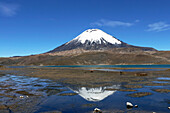
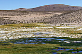
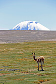
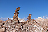
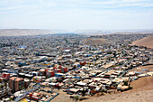
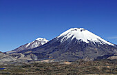
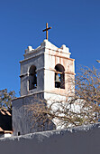
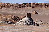
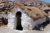
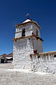
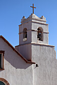
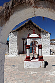
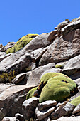
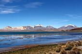
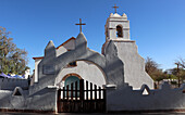
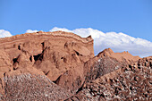
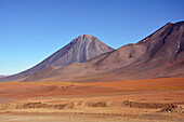
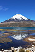
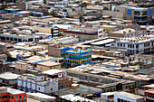
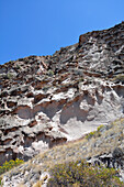
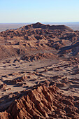
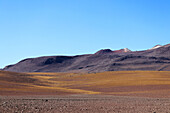
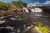
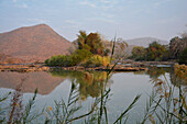
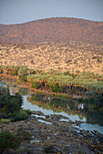
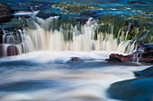
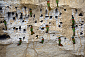
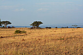
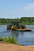
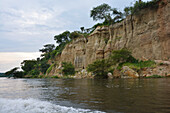
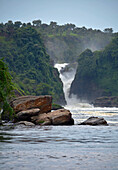
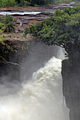
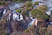
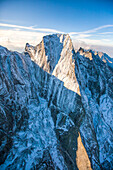
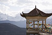
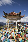
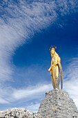
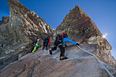
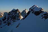
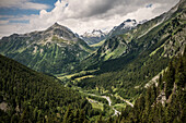
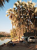
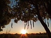
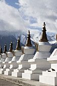
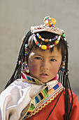
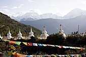
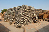
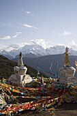
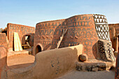
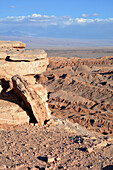
71452257 - Chile; Northern Chile; Arica y Parinacota Region; on the border with Bolivia; Lauca National Park; Parinacota Volcano; reflected on the water surface of Lake Chungara 71452265 - Chile; Northern Chile; Arica y Parinacota Region; on the border with Bolivia; Lauca National Park; salt-encrusted floodplain landscape; Bofedal meadows; sparsely covered hills 71452262 - Chile; Northern Chile; Arica y Parinacota Region; on the border with Bolivia; Lauca National Park; Vicuna in a Bofedal meadow; in the background on the Bolivian side the top of the Sajama volcano 71452222 - Chile; Northern Chile; Antofagasta Region; Cordillera del Sal; on the border with Bolivia; at San Pedro de Atacama; Valle de la Luna; "Tres Marias" rock formation; you can see two of the three Marys 71452279 - Chile; northern Chile; Arica y Parinacota Region; on the border with Peru; View of the city of Arica; taken from El Morro de Arica rock 71452259 - Chile; Northern Chile; Arica y Parinacota Region; on the border with Bolivia; Lauca National Park; Parinacota Volcano; behind it the twin volcano Pomerape 71452243 - Chile; northern Chile; Antofagasta Region; on the border with Bolivia; San Pedro de Atacama; Bell tower of the church of San Pedro in the center of the town 71452220 - Chile; northern Chile; Antofagasta Region; Cordillera del Sal; on the border with Bolivia; at San Pedro de Atacama; Valle de la Luna 71452277 - Chile; northern Chile; Arica y Parinacota Region; on the border with Bolivia; Lauca National Park; Parinacota Village; old house; surrounded by dry stone wall 71452273 - Chile; northern Chile; Arica y Parinacota Region; on the border with Bolivia; Lauca National Park; Parinacota Village; Church 71452242 - Chile; Northern Chile; Antofagasta Region; on the border with Bolivia; San Pedro de Atacama; Bell tower of the church of San Pedro in the center 71452219 - Chile; northern Chile; Antofagasta Region; Cordillera del Sal; on the border with Bolivia; at San Pedro de Atacama; Valle de la Luna 71452274 - Chile; Northern Chile; Arica y Parinacota Region; on the border with Bolivia; Lauca National Park; Parinacota Village; Village church 71452267 - Chile; northern Chile; Arica y Parinacota Region; on the border with Bolivia; Lauca National Park; rocks covered with yareta; typical flora of the Andes 71452258 - Chile; Northern Chile; Arica y Parinacota Region; on the border with Bolivia; Lauca National Park; Lake Chungara with mountains in the background 71452241 - Chile; northern Chile; Antofagasta Region; on the border with Bolivia; San Pedro de Atacama; San Pedro church in the center 71452221 - Chile; northern Chile; Antofagasta Region; Cordillera del Sal; on the border with Bolivia; at San Pedro de Atacama; Valle de la Luna 71452207 - Chile; Northern Chile; Antofagasta Region; on the border with Bolivia; Licancabur Volcano; in the foreground the foothills of the Juriques volcano 71452256 - Chile; Northern Chile; Arica y Parinacota Region; on the border with Bolivia; Lauca National Park; Parinacota Volcano; reflected on the water surface of Lake Chungara 71452280 - Chile; northern Chile; Arica y Parinacota Region; on the border with Peru; View of the city of Arica; taken from El Morro de Arica rock 71452250 - Chile; northern Chile; Arica y Parinacota Region; on the border with Bolivia; on the ancient Inca trails in the hinterland of Putre; along the Jurase gorge 71452278 - Chile; northern Chile; Arica y Parinacota Region; on the border with Peru; Arica; El Morro de Arica rocks 71452208 - Chile; northern Chile; Antofagasta Region; Atacama Desert; on the border with Bolivia; Licancabur volcano 71452276 - Chile; northern Chile; Arica y Parinacota Region; on the border with Bolivia; Lauca National Park; Parinacota Village; small figure on the church wall; probably a bishop 71452272 - Chile; northern Chile; Arica y Parinacota Region; on the border with Bolivia; Lauca National Park; Parinacota Village; Church 71452223 - Chile; northern Chile; Antofagasta Region; Cordillera del Sal; on the border with Bolivia; at San Pedro de Atacama; Valle de la Luna 71452209 - Chile; Northern Chile; Antofagasta Region; Atacama Desert; on the border with Bolivia; Mountain landscape 71412482 - Orinduik Falls, Potaro-Siparuni Region, Brazil Guyana border, GUYANA.71416523 - Namibia; Kunene Region; northern Namibia; Kaokoveld; at Epupa; Kunene River; lush vegetation on the shore with palm trees and reeds; Border river with Angola71416521 - Namibia; Kunene Region; northern Namibia; Kaokoveld; at Epupa; Kunene River; barren landscape in the dry season; Border river with Angola71412481 - Orinduik Falls, Potaro-Siparuni Region, Brazil Guyana border, GUYANA.71377686 - Uganda; Northern Region on the border with the Western Region; Murchison Falls National Park; on the Victoria Nile; European red-throated spiders in front of their nesting holes71377716 - Uganda; Western Region; Queen Elizabeth National Park; Ishasha plain in the southern part on the border with the Democratic Republic of the Congo; Grass savannah with acacia trees;71377693 - Uganda; Northern Region on the border with the Western Region; Murchison Falls National Park; on the Victoria Nile; Giraffe transport on the ferry at Paraa71377688 - Uganda; Northern Region on the border with the Western Region; Murchison Falls National Park; Riverside landscape on the Victoria Nile; green vegetation and steep cliffs71377687 - Uganda; Northern Region on the border with the Western Region; Murchison Falls National Park; Victoria Nile; Nile crocodile on the shore; open mouth for temperature regulation71377694 - Uganda; Northern Region on the border with the Western Region; Murchison Falls National Park; on the Victoria Nile; lower cascades of the Murchison waterfall71377684 - Uganda; Northern Region on the border with the Western Region; Murchison Falls National Park; Hippo in the Victoria Nile71402370 - in the steps of the 'orlogeur', morteau region, boat ride on the doubs from besancon to the swiss border, (25) doubs, region bourgogne-franche-comte, france71377696 - Uganda; Northern Region on the border with the Western Region; Murchison Falls National Park; on the Victoria Nile; The spray and thundering whirlpools of the Murchison waterfall71377695 - Uganda; Northern Region on the border with the Western Region; Murchison Falls National Park; on the Victoria Nile; The spray and thundering whirlpools of the Murchison waterfall70888871 - Landscape near Gliczarow village, 10km from Zakopane (Tatra Mountains Region) and 14km from Lysa Polana (border with Slovakia). Podhale Region, Poland, Europe70336472 - Sand, Saf Saf river, border with Algeria, oasis of Figuig, province of Figuig, Oriental Region, Morocco70336471 - Saf Saf river, border with Algeria, oasis of Figuig, province of Figuig, Oriental Region, Morocco71416522 - Namibia; Kunene region; northern Namibia; Kaokoveld; at Epupa; Kunene River; lush vegetation on the bank; Border river with Angola71416520 - Namibia; Kunene Region; northern Namibia; Kaokoveld; at Epupa; Kunene River; Epupa Falls in the dry season; Border river with Angola71416519 - Namibia; Kunene Region; northern Namibia; Kaokoveld; at Epupa; Kunene River; Epupa Falls in the dry season; Border river with Angola71337729 - Malawi; Central Region; National road M1 along the border with Mozambique; View from the road to the landscape over the border00290437 - Collio region on the Slovenian border, Friuli, Italy71046588 - Shangri-La, formerly Zhongdian, on the Tibetan Border, Shangri-La region, Yunnan Province, China, Asia71035589 - Epupa Falls on the Kunene River (which forms the border between Namibia and Angola), Kunene Region (formerly Kaokoland), Namibia, Africa71035591 - Kunene River which forms the border between Namibia and Angola, near Epupa Falls, Kunene Region (formerly Kaokoland), Namibia, Africa71035590 - Epupa Falls on the Kunene River (which forms the border between Namibia and Angola), Kunene Region (formerly Kaokoland), Namibia, Africa70499082 - The clean granite of the impressive northeast face of the Piz Badile overlooking the Bondasca valley from the helicopter. It is a mountain of the Bregaglia range in the Swiss canton of Graubünden and the Italian region of Lombardy, the border between the 71044734 - Buddhist stupa on way to Deqin, on the Tibetan Border, with the Meili Snow Mountain peak in the background, Dequin, Shangri-La region, Yunnan Province, China, Asia71046587 - Buddhist stupa, Deqin, called Shangri-La, on the Tibetan Border, Shangri-La region, Yunnan Province, China, Asia71044737 - Shangri-La, formerly Zhongdian, on the Tibetan Border, Shangri-La region, Yunnan Province, China, Asia71188230 - border crossing point in the village of saint-gingolph, region of lake geneva, canton of valais, switzerland13999418 - A framing of a field in southwestern Gemini rich in star clusters and nebulas. At top right is the rich star cluster Messier 35 and its small more distant companion cluster NGC 2158. At bottom right is the emission nebula NGC 2174 that is over the border in northern Orion. Above centre is the supernova remnant IC 443 arcing to the east of the orange star Propus or Eta Geminorum. The large diffuse nebula at left is IC 444 above the orange star Tejat Posterior or Mu Geminorum. The large,loose cluster Collinder 89 is embedded in IC 444. That region also has some blue reflection nebulosity,as does13898423 - The region of nebulosity on the Cepheus-Cassiopeia border with NGC 7822 (top) and Ced 214 (bottom). This is a stack of 15 x 7 minute exposures at f/4.4 with the 92mm apo refractor and filter-modified Canon 5D Mark II at ISO 800. Taken from New Mexico. Focus is a little soft.13814608 - Sunset over Dream Lake and Kizil-Asker glacier, Kakshaal Too in the Tian Shan mountain range near the Chinese border, Naryn Region, Kyrgyzstan, Central Asia, Asia13814621 - Alpine lake, Kakshaal Too in the Tian Shan mountain range near the Chinese border, Naryn Region, Kyrgyzstan, Central Asia, Asia13814614 - Alpine lake, Kakshaal Too in the Tian Shan mountain range near the Chinese border, Naryn Region, Kyrgyzstan, Central Asia, Asia13814603 - Alpine lake, Kakshaal Too in the Tian Shan mountain range near the Chinese border, Naryn Region, Kyrgyzstan, Central Asia, Asia13814601 - Alpine lake, Kakshaal Too in the Tian Shan mountain range near the Chinese border, Naryn Region, Kyrgyzstan, Central Asia, Asia13814597 - Camp at the base of Kizil-Asker glacier, Kakshaal Too in the Tian Shan mountain range near the Chinese border, Naryn Region, Kyrgyzstan, Central Asia, Asia13814619 - Dream Lake and Marco Polo Agali skull, Kakshaal Too mountains, Tian Shan at the Chinese border, Naryn Region, Kyrgyzstan, Central Asia, Asia13814604 - Kizil-Asker glacier, Kakshaal Too in the Tian Shan mountain range near the Chinese border, Naryn Region, Kyrgyzstan, Central Asia, Asia13814602 - Dream Lake, Kakshaal Too in the Tian Shan mountains near the Chinese border, Naryn Region, Kyrgyzstan, Central Asia, Asia13814612 - Kyrgyz nomads and sheep herd, Tian Shan mountains near the Chinese border, Naryn Region, Kyrgyzstan, Central Asia, Asia71341072 - View from Wasserklotz (Reichraminger Hintergebirge) towards the Haller Mauern / Nördliche Kalkalpen, border region between Upper Austria and Styria, Austria.71018232 - Alpinists traversing the exposed ridge of Breithorn Mittelgipfel, Valais Alps, canton of Valais and region of Aosta Valley, national border of Switzerland and Italy71018231 - Alpinists abseiling from the summit of the western Breithornzwilling, Breithorn Massif, Valais Alps, canton of Valais and region of Aosta Valley, national border of Switzerland and Italy71018338 - A female and a male mountaineer carrying their touring skis on their backpacks and ascending a steep snow slope, summit of Roccia Nera, Breithorn massif, Pennine Alps, canton of Valais and region of Aosta Valley, national border of Switzerland and Italy71018229 - A male and a female alpinist on the summit ridge of Roccia Nera, one of the five summits of the Breithorn massif, next to them big cornices, Valais Alps, canton of Valais and region of Aosta Valley, national border of Switzerland and Italy71018225 - A female mountaineer walking on an exposed ridge, south ridge of Monte Leone, Lepontine Alps, canton of Valais and region of Piedmont, national border of Switzerland and Italy71018292 - Golden statue of the Virgin Mary on the Monte Moro Pass, Pennine Alps, canton of Valais, Region of Piedmont, national border of Switzerland and Italy71018227 - Mountaineers ascending the crux section of the southwest ridge of Pollux holding on to fixed ropes, Valais Alps, canton of Valais and region of Aosta Valley, national border of Switzerland and Italy71018230 - on the summit ridge of Roccia Nera, one of the five summits of the Breithorn massif, next to them big cornices, Valais Alps, canton of Valais and region of Aosta Valley, national border of Switzerland and Italy70502989 - View of alpine peaks around Lake Silvaplana near St. Moritz, border region of Switzerland and Italy71018228 - Two alpinists on the summit ridge of Roccia Nera, one of the five summits of the Breithorn massif, above them big cornices in the morning sun, behind them the summit of Castor, Valais Alps, canton of Valais and region of Aosta Valley, national border of S70313565 - Namibia - The beautiful campsite of the Omarunga Camp in the shade of Makalani palm trees Hyphaene petersiana at the bank of the Kunene River very close to the Epupa Falls The Kunene is border river between Namibia and Angola Kaokoland, Kunene region, N70321889 - Sausage Tree Kigelia africana - At sunset at the bank of the Okavango River which is border river between Namibia and Angola the sun is setting on the Angolan side Kavango region, northern Namibia70239451 - China Yunnan Shangri-La region Dequin, called Shangri-La on the Tibetan Border Buddhist Stupas70239453 - China Yunnan Shangri-La region Zhongdian, called Shangri La, on the Tibetan Border Girl of Naxi minority people MODEL RELEASE 110071038704 - Buddhist stupas with Meili Snow Mountain peak in background, en route to the Tibetan border, Deqin, Shangri-La region, Yunnan Province, China, Asia70239449 - China Yunnan Shangri-La region Dequin, called Shangri-La Road from Zhongdian to Dequin, on the Tibetan Border Buddhist Stupa Naxi Woman71044735 - Buddhist stupa on way to Deqin, on the Tibetan Border, with the Meili Snow Mountain peak in the background, Dequin, Shangri-La region, Yunnan Province, China, Asia70321829 - Namibia - At the beautiful Epupa Falls the Kunene River border river between Namibia and Angola drops in a series of cascades into a 60m deep gorge Kaokoland, Kunene region, Namibia70239450 - China Yunnan Shangri-La region Dequin, called Shangri-La on the Tibetan Border Buddhist Stupas71046329 - Woman of Naxi minority people, on Tibetan Border, Shangri-La region, formerly called Zhongdian, Yunnan Province, China, Asia71044736 - Buddhist stupa on way to Deqin, on the Tibetan Border, with the Meili Snow Mountain peak in the background, Dequin, Shangri-La region, Yunnan Province, China, Asia71037632 - Buddhist stupa with Meili Snow Mountain peak in background, en route to the Tibetan border, Deqin, Shangri-La region, Yunnan Province, China, Asia70363012 - Burkina Faso, village of Tangasomogo, fortified houses in the Tiebélé region on the border of Burkina Faso and Ghana, frescoes on the walls of their mud huts71046586 - Buddhist stupas on way to Deqin, on the Tibetan Border, with the Meili Snow Mountain peak in the background, Dequin, Shangri-La region, Yunnan Province, China, Asia70363011 - Burkina Faso, village of Tangasomogo, fortified houses in the Tiebélé region on the border of Burkina Faso and Ghana, frescoes on the walls of their mud huts70239452 - China Yunnan Shangri-La region Zhongdian, now called Shangri-La on the Tibetan Border Buddhist Stupa71046589 - Shangri-La, formerly Zhongdian, on the Tibetan Border, Shangri-La region, Yunnan Province, China, Asia71452218 - Chile; northern Chile; Antofagasta Region; Atacama Desert; at San Pedro de Atacama; Cordillera del Sal; Valle de la Luna; next page