Border area Photos – License unique travel photos ❘ lookphotos
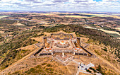
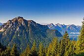
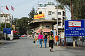
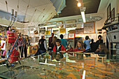
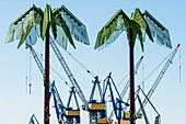
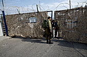
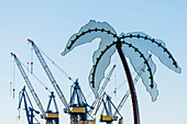
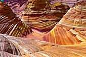
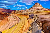
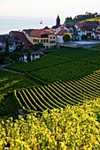
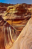
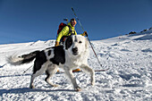
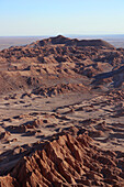
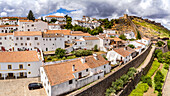
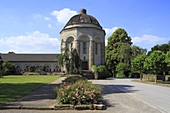
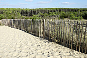
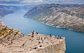
71396343 - Aerial view of the star-shaped Santa Luzia Fort near Elvas, Portugal, border area with Spain71388922 - View from Tegelberg to the Säuling mountain in the German-Austrian border area. Fussen, Allgaeu, Swabia, Bavaria, Germany, Europe70173734 - Four women at the Ledra Palace checkpoint, border, Green Line, United Nations Controlled Area, divided city, Lefkosia, Nicosia, Cyprus71088916 - A metal palm tree in the green area Park Fiction on the border Altona Old Town to St. Pauli with look at cranes of the shipyard Blohm and Voss, Hamburg, Germany70133288 - Border Area Museum, Grenzland Museum, Tettenborn, Saxony Anhalt, Harz mountains, Germany71088917 - Two metal palm trees in the green area Park Fiction on the border Altona Old Town to St. Pauli with look at cranes of the shipyard Blohm and Voss, Hamburg, Germany70173728 - UN border on Ledra Street, UN controlled area, Buffer Zone, Green Line, divided city, Lefkosia, Nicosia, South Cyprus, Cyprus71088918 - Two metal palm trees in the green area Park Fiction on the border Altona Old Town to St. Pauli with look at cranes and a cruise liner in the dock of the shipyard Blohm and Voss, Hamburg, Germany71053006 - Soldier opening a door for another soldier, Military Area, Border from Israel to Lebanon, Israel71088915 - A metal palm tree in the green area Park Fiction on the border Altona Old Town to St. Pauli with look at cranes of the shipyard Blohm and Voss, Hamburg, Germany70387733 - The Wave , a 190 million year old Jurassic-age Navajo sandstone rock formation, Coyote Buttes North, Paria Canyon-Vermillion Cliffs Wilderness Area, Utah-Arizona border, USA70387730 - Coyote Buttes North, Paria Canyon-Vermillion Cliffs Wilderness Area, Utah-Arizona border, USA70173727 - UN border on Ledra Street, UN controlled area, Buffer Zone, Green Line, divided city, Lefkosia, Nikosia, South Cyprus, Cyprus70404630 - View of Lavaux and Lake Leman Lavaux is part of a World Heritage Site and is a wine production area with terraces formed since the time of the Romans Lake Geneva is located on the border between Switzerland and France70387732 - The Wave , a 190 million year old Jurassic-age Navajo sandstone rock formation, Coyote Buttes North, Paria Canyon-Vermillion Cliffs Wilderness Area, Utah-Arizona border, USA70404629 - View of Lavaux and Lake Leman Lavaux is part of a World Heritage Site and is a wine production area with terraces formed since the time of the Romans Lake Geneva is located on the border between Switzerland and France70387736 - Coyote Buttes North, Paria Canyon-Vermillion Cliffs Wilderness Area, Utah-Arizona border, USA70387734 - Hikers exploring ´The Wave´, a 190 million year old Jurassic-age Navajo sandstone rock formation, Coyote Buttes, Paria Canyon-Vermillion Cliffs Wilderness Area, Utah-Arizona border, USA70387737 - Coyote Buttes North, Paria Canyon-Vermillion Cliffs Wilderness Area, Utah-Arizona border, USA70387729 - Coyote Buttes North, Paria Canyon-Vermillion Cliffs Wilderness Area, Utah-Arizona border, USA70404628 - View of Lavaux and Lake Leman Lavaux is part of a World Heritage Site and is a wine production area with terraces formed since the time of the Romans Lake Geneva is located on the border between Switzerland and France70387735 - The Wave , a 190 million year old Jurassic-age Navajo sandstone rock formation, Coyote Buttes North, Paria Canyon-Vermillion Cliffs Wilderness Area, Utah-Arizona border, USA70387731 - Hiker exploring ´The Wave´, a 190 million year old Jurassic-age Navajo sandstone rock formation, Coyotte Buttes, Paria Canyon-Vermillion Cliffs Wilderness Area, Utah-Arizona border, USA13847263 - Lower Klamath National Wildlife Refuge, White Lake area along Hwy 161 on the California-Oregon border.13900504 - The dark nebula on the Cygnus-Cepheus border nicknamed the Funnel Cloud Nebula (a name provided by Alan Whitman in a 2006 Sky and Telescope article) but that is a very prominent naked eye feature to the northern Milky Way, more obvious as a dark area than the Northern Coal Sack to the south. This is a fine object for binoculars and the telephoto lens shot here provides the field of most binoculars.13897822 - The area near Sirius (at lower right) including the Seagull Nebula (at top left) also called IC 2177, on the Canis Major-Monoceros border.13848371 - Rafters and fisherman in inflatable boats on Snake River, Hells Canyon National Recreation Area, Oregon-Idaho border.13893777 - Flaming Gorge National Recreation Area, Wyoming-Utah Border, USA71391260 - Rift zone in the border area of two tectonic plates. Here the drifting apart of the American and Eurasian tectonic plates becomes visible through imposing crevices and cracks; Southland, Iceland70907224 - young man swimming in the Wakenitz river, along the former German border between East and West, area so called Amazona of the North, Schleswig-Holstein, Germany70907225 - canoeing along the Wakenitz river, along the former German border between East and West, area so called Amazona of the North, Schleswig-Holstein, Germany13188315 - A graveyard near Sinz, Perl, Saarland, Germany (tri-border area)13188303 - A vineyard hiking route with a view of Sierck-les-Bains, France (tri-border area)70907226 - canoeing along the Wakenitz river, along the former German border between East and West, area so called Amazona of the North, Schleswig-Holstein, Germany13188306 - A vineyard hiking route near Perl, Germany (tri-border area)13188307 - A vineyard hiking route near Perl, Germany (tri-border area)13188302 - Geraniums in a window box with open shutters and a road name sign, Apach, France (tri-border area)13188295 - A vineyard hiking route with a view of Apach, France (tri-border area)13188232 - Tri-border area near Perl, Germany with a view of France and Luxembourg70907223 - canoeing along the Wakenitz river, along the former German border between East and West, area so called Amazona of the North, Schleswig-Holstein, Germany13188310 - Two donkeys along a vineyard hiking route (tri-border area)70907221 - canoeing along the river Wakenitz, along the former German border between East and West, area so called Amazona of the North, Schleswig-Holstein, Germany13188296 - A vineyard hiking route with a view of Apach, France (tri-border area)13188294 - A vineyard hiking route with a view of Apach, France (tri-border area)13188308 - A vineyard hiking route near Perl, Germany (tri-border area)13188305 - A vineyard hiking route with a view of France and Luxembourg (tri-border area)70907222 - young couple canoeing along the Wakenitz river, along the former German border between East and West, area so called Amazona of the North, Schleswig-Holstein, Germany70285411 - Rainbow Bridge arch world´s largest known natural bridge, Rainbow Bridge National Monument, Lake Powell, Glen Canyon National Recreation Area, Arizona/Utah border USA70285413 - Lake Powell, Glen Canyon National Recreation Area, Arizona/Utah border USA70202436 - The small surma tribe live along the Kibish river west to the Omo river in the lower Omo valley. The area is very near to the border of Sudan.70907219 - canoeing along the river Wakenitz, along the former German border between East and West, area so called Amazona of the North, Schleswig-Holstein, Germany70256713 - Orabidea is a forest spot, located in Baztan, an area of the north of Navarra, close to the French border. There is a path at the end of Orabideas road leading to the Hells Mill (Infernuko Errota) built on the river.70126958 - Garden Border Sitting Area70285410 - Lake Powell, Glen Canyon National Recreation Area, Arizona/Utah border USA70256709 - Orabidea is a forest spot, located in Baztan, an area of the north of Navarra, close to the French border. There is a path at the end of Orabideas road leading to the Hells Mill (Infernuko Errota) built on the river.70256711 - Orabidea is a forest spot, located in Baztan, an area of the north of Navarra, close to the French border. There is a path at the end of Orabideas road leading to the Hells Mill (Infernuko Errota) built on the river.70256710 - Orabidea is a forest spot, located in Baztan, an area of the north of Navarra, close to the French border. There is a path at the end of Orabideas road leading to the Hells Mill (Infernuko Errota) built on the river.71038695 - Monument Valley Navajo Tribal Park, Utah Arizona border area, United States of America, North America71038694 - Monument Valley Navajo Tribal Park, Utah Arizona border area, United States of America, North America70285414 - Gunsight Butte, Lake Powell, Glen Canyon National Recreation Area, Arizona/Utah border USA70285412 - Lake Powell, Glen Canyon National Recreation Area, Arizona/Utah border USA70256714 - Orabidea is a forest spot, located in Baztan, an area of the north of Navarra, close to the French border. There is a path at the end of Orabideas road leading to the Hells Mill (Infernuko Errota) built on the river.70256712 - Orabidea is a forest spot, located in Baztan, an area of the north of Navarra, close to the French border. There is a path at the end of Orabideas road leading to the Hells Mill (Infernuko Errota) built on the river.70501476 - Buddhist chortens or stupas and mani stones lie in green valley, Zanskar Mountains, Ladakh, northern India. This predominantly Buddhist area is near the border with Tibet, China.71038697 - Monument Valley Navajo Tribal Park, Utah Arizona border area, United States of America, North America71188967 - arvin berod nicolas with his 2-year-old border collie jango approaching the review area for cross-country skiing, reporting on avalanche dog handlers, training organized by the anena with the approval of the civil security department, les-2-alpes (38), fr71179589 - Winter landscape scenes near Morzine, France, part of the Portes du Soleil ski area along the France - Switzerland border.71179590 - Winter landscape scenes near Morzine, France, part of the Portes du Soleil ski area along the France - Switzerland border.71452223 - Chile; northern Chile; Antofagasta Region; Cordillera del Sal; on the border with Bolivia; at San Pedro de Atacama; Valle de la Luna 71396341 - Aerial view of the historic buildings and city fortress of Marvao on the Spanish border, Portugal71389751 - Boundary post on the Goetheweg, hiking trail on the former border with the GDR, ascent to the Brocken, Torfhaus, Lower Saxony, Germany71368643 - Former inner-German border between Thuringia and Bavaria near Eisfels, Thuringia, Germany71368640 - Former inner-German border between Thuringia and Bavaria near Eisfels, Thuringia, Germany71328334 - Herzerl Straße in autumn directly on the border between Styria and Slovenia71368642 - Former inner-German border between Thuringia and Bavaria near Eisfels, Thuringia, Germany71368641 - Former inner-German border between Thuringia and Bavaria near Eisfels, Thuringia, Germany71336522 - Lonely hut and trees stand in the flooded Torneälv, Sweden-Finland border, Norrbottens Län, Sweden71328335 - Herzerl Straße in autumn directly on the border between Styria and Slovenia71396340 - View over the Serra de Sao Mamede from the castle and ramparts of the town of Marvao on the Spanish border, Portugal13889676 - Israel, situated on Eastern slope of Mount of Olives; Bethany, Fenced in area is ancient Bethany and present day Arab village of Al-Ezareyya70485928 - 'Metal Gate Locked On A Dirt Road In Glen Canyon National Recreation Area; Utah, United States of America'71111399 - Ses Covetes beach, protected natural area, Campos, Mallorca, Balearic Islands, Spain, Europe.70295479 - D-Oberhausen, Ruhrgebiet, Niederrhein, Nordrhein-Westfalen, NRW, Schloss Oberhausen, Museum, Kunstausstellung, D-Oberhausen, Ruhr area, Lower Rhine, North Rhine-Westphalia, castle Oberhausen, museum, art exhibition *** Local Caption *** D-Oberhausen, Ruhr71106083 - Silhouette of a woman with a hat in a narrow canyon. Jordan, Wadi Rum desert, protected area inscribed on UNESCO World Heritage list. Model Released.71100618 - Ibañeta forest at Roncesvalles pass form spanish area frontier with France.71111400 - Carbó beach,Ses Salines, , protected natural area, Majorca, Balearic Islands, Spain71106082 - Silhouette of a woman contemplating the landscape from the mount Jebel Burdah. Jordan, Wadi Rum desert, protected area inscribed on UNESCO World Heritage list. Model Released.71106079 - Silhouette of a woman and red sand desert from Jebel Qattar. Jordan, Wadi Rum desert, protected area inscribed on UNESCO World Heritage list. Model Released.71105208 - 'The Bisti/De-Na-Zin Wilderness is a 45,000-acre wilderness area located in San Juan County in the U. S. state of New Mexico. Established in 1984, the Wilderness is a desolate area of steeply eroded badlands managed by the Bureau of Land Management, with 70712089 - From Victoria Falls is possible to visit the nearby Botswana. Specifically Chobe National Park. Chobe National Park. The Chobe National Park is located in the Northern part of Botswana and comprises an area of approximately 11 000 km². The park lies along71111398 - Ses Covetes beach, protected natural area, Campos, Mallorca, Balearic Islands, Spain, Europe.71105283 - 'blue lizard;. Jordan, Wadi Rum desert, protected area inscribed on UNESCO World Heritage list.'71100066 - Preikestolen, Pulpit Rock, 600 meters over LyseFjord, Lyse Fjord, in Ryfylke district, Rogaland Region, It is the most popular hike in Stavanger area, Norway.71100065 - Preikestolen, Pulpit Rock, 600 meters over LyseFjord, Lyse Fjord, in Ryfylke district, Rogaland Region, It is the most popular hike in Stavanger area, Norway.70405569 - Mirpe Square, is bordered by beatiful medieval half-timbered houses The area was completely restored in the 70´s Bergerac, Aquitaine, Dordogne, France70295383 - D-Dortmund, Ruhrgebiet, Nordrhein-Westfalen, D-Dortmund-Brackel, Hauptfriedhof Dortmund, Urnenhalle, Altes Krematorium, Stil der Neuen Sachlichkeit, Historismus, Route der Industriekultur, D-Dortmund, Ruhr area, North Rhine-Westphalia, D-Dortmund-Brackel70256760 - Boundary fence at dunes area, Lacanau-Océan. Gironde, Aquitaine, France71106081 - Silhouette of a woman and red sand desert in Jebel Khazali area. Jordan, Wadi Rum desert, protected area inscribed on UNESCO World Heritage list. Model Released.71100106 - Preikestolen, Pulpit Rock, 600 meters over LyseFjord, Lyse Fjord, in Ryfylke district, Rogaland Region, It is the most popular hike in Stavanger area, Norway.next page