Area M Photos – License unique travel photos ❘ lookphotos
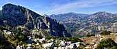
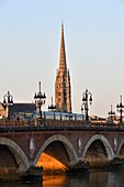
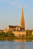
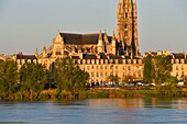
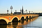
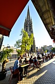
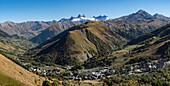
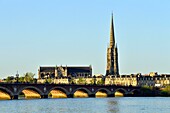
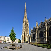
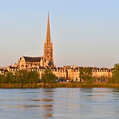
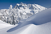
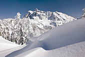
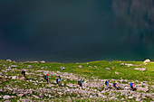
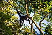
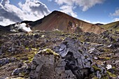
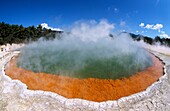
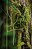
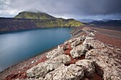
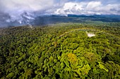
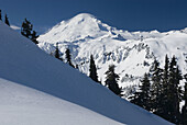
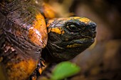
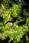
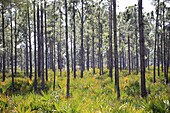
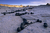
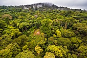
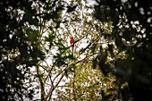
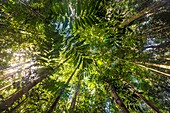
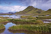
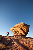
71433912 - View from Bernia to the Aitana area 1585 m. Highest hiking area on the Costa Blanca, Spain71377372 - View of the outside area of the Architecture Biennale 2021, in the foreground the Electa book pavilion by James Stirling and M. Wilford, Venice, Veneto, Italy, Europe13973831 - France,Gironde,Bordeaux,area listed as World Heritage by UNESCO,Pont de Pierre on the Garonne River and Saint Michel Basilica built between the 14th and 16th century Gothic style and it's tower of 114 m high13972143 - France,Gironde,Bordeaux,area listed as World Heritage by UNESCO,the banks of Garonne river and Saint Michel Basilica built between the 14th and 16th century Gothic style and it's tower of 114 m high13972845 - France,Gironde,Bordeaux,area listed as World Heritage by UNESCO,the banks of Garonne river and Saint Michel Basilica built between the 14th and 16th century Gothic style and it's tower of 114 m high13978436 - France,Gironde,Bordeaux,area listed as World Heritage by UNESCO,the banks of Garonne river and Saint Michel Basilica built between the 14th and 16th century Gothic style and it's tower of 114 m high13978752 - France,Gironde,Bordeaux,area listed as World Heritage by UNESCO,Pont de Pierre on the Garonne River and Saint Michel Basilica built between the 14th and 16th century Gothic style and it's tower of 114 m high13974376 - France,Gironde,Bordeaux,area listed as World Heritage by UNESCO,the banks of Garonne river and Saint Michel Basilica built between the 14th and 16th century Gothic style and it's tower of 114 m high13979791 - France,Gironde,Bordeaux,area listed as World Heritage by UNESCO,Pont de Pierre on the Garonne River and Saint Michel Basilica built between the 14th and 16th century Gothic style and it's tower of 114 m high13979583 - France,Gironde,Bordeaux,area listed as World Heritage by UNESCO,Saint Michel district,Meynard square,Saint Michel Basilica built between the 14th and 16th century Gothic style and it's tower of 114 m high13978830 - France,Savoie,Saint Jean de Maurienne,the largest cycling area in the world was created within a radius of 50 km around the city. At the cross of the Iron Cross (2067 m) panoramic view of Saint Sorlin d'Arves and the needles of Arves13976330 - France,Gironde,Bordeaux,area listed as World Heritage by UNESCO,Pont de Pierre on the Garonne River and Saint Michel Basilica built between the 14th and 16th century Gothic style and it's tower of 114 m high13974034 - France,Gironde,Bordeaux,area listed as World Heritage by UNESCO,Saint Michel district,Meynard square,Saint Michel Basilica built between the 14th and 16th century Gothic style and it's tower of 114 m high13973799 - France,Gironde,Bordeaux,area listed as World Heritage by UNESCO,the banks of Garonne river and Saint Michel Basilica built between the 14th and 16th century Gothic style and it's tower of 114 m high71342711 - Mountain hiking in the Texel Group Nature Park, the Spronser Lakes area, the largest high-alpine lake district in Europe. The Grünsee lies at 2,338 m above sea level and is a hydrological natural monument.71019338 - The Grialetsch area with Grialetsch Glacier, Piz Sarsura (right hand, 3178 m) and Piz Sarsura Pitschen left hand (3134 m), Grisons, Switzerland, Europe70451642 - A gillnet catching salmon as it stretches towards Cape Pankoff on Unimak Island. Salmon fishing in the Alaska Department of Fish and Game 'Alaska Peninsula Area' also known as 'Area M'. This has been a controversial fishing region.71342715 - Mountain hiking in the Texel Group Nature Park, the Spronser Lakes area, the largest high-alpine lake district in Europe. The Grünsee lies at 2,338 m above sea level and is a hydrological natural monument.71342714 - Mountain hiking in the Texel Group Nature Park, the Spronser Lakes area, the largest high-alpine lake district in Europe. The Grünsee lies at 2,338 m above sea level and is a hydrological natural monument.71342716 - Mountain hiking in the Texel Group Nature Park, the Spronser Lakes area, the largest high-alpine lake district in Europe. The Grünsee lies at 2,338 m above sea level and is a hydrological natural monument.71019337 - Ski-tourer in front of the Grialetsch area with Grialetsch Glacier, Piz Sarsura (right hand, 3178 m) and Piz Sarsura Pitschen left hand (3134 m), Grisons, Switzerland, Europe71342713 - Mountain hiking in the Texel Group Nature Park, the Spronser Lakes area, the largest high-alpine lake district in Europe. The Grünsee lies at 2,338 m above sea level and is a hydrological natural monument.70185949 - Highest area of Central Madeira Island, Portugal: volcano Pico Ruivo (1862 m) viewed from the Pico do Arieiro, showing also common Atlantic fog in the north slopes71329074 - France, Guyana, French Guyana Amazonian Park, heart area, Camopi, spider monkey red face (Ateles paniscus) in the canopy on Mount Itoupe (830 m), the second summit of Guyana, in the mountain range of the Table Mountains, which presents particular ecosystem to its cloud forest, the study will provide global climate change indicators70284949 - Mount Shuksan 9, 127 feet 2, 782 m in winter seen from Kulshan Ridge of Heather Meadows Recreation Area, North Cascades Washington USA70284948 - Mount Shuksan 9, 127 feet 2, 782 m in winter seen from Kulshan Ridge of Heather Meadows Recreation Area, North Cascades Washington USA71342712 - Mountain hiking in the Texel Group Nature Park, the Spronser Lakes area, the largest high-alpine lake district in Europe. The Grünsee lies at 2,338 m above sea level and is a hydrological natural monument.71329060 - France, Guyana, French Guyana Amazonian Park, heart area, Camopi, spider monkey in juvenile red face (Ateles paniscus) in the canopy on Mount Itoupe (830 m), the second summit of Guyana, in the mountain range of the Table Mountains, which presents particular ecosystem to its cloud forest, the study will provide global climate change indicators71040596 - Brennisteinsalda, 855 m, Iceland's most colourful mountain, dominates the lava fields of Laugahraun, Landmannalaugar area, Fjallabak region, Iceland, Polar Regions70354597 - Active, Activities, Activity, Area, Beautiful, Beauty, Blue, Burning, Calm, Champagne pool, Colored, Colorful, Crater, Famous place, Fish eye, Fume, Fumes, Geologic, Geology, Geothermal, Geothermic, Green, Haze, Hazy, Heat, Hot, Hot spring, Hot springs, M71329069 - France, Guyana, French Guyana Amazonian Park, heart area, Mount Itoupe, rainy season, swinging stick insect to mimic the movement of vines on a mossy trunk in forest summit clouds (830 m)71040599 - Blahylur crater lake in the Landmannalaugar area,Tjorvafell, 843 m in the distance, Fjallabak region, Iceland, Polar Regions71329063 - France, Guyana, French Guyana Amazonian Park, heart area, overlooking the Amazon plain since the tabular chain of Mount Itoupe (830 m), rainy season, aerial view from helicopter transport of the scientific team71329059 - France, Guyana, French Guyana Amazonian Park, heart area, Camopi, spider monkey red face (Ateles paniscus) in the canopy on Mount Itoupe (830 m), the second summit of Guyana, in the mountain range of the Table Mountains, which presents particular ecosystem to its cloud forest, the study will provide global climate change indicators70284952 - Mount Baker 10, 778 ft 3, 285 m in winter seen from Artists point of heather Meadows Recreation Area, North Cascades Washington USA71329082 - France, Guyana, French Guyana Amazonian Park, heart area, Mount Itoupe, rainy season, portrait of a tortoise (Chelonoidis denticulata) on litter the undergrowth (700 m)71329075 - France, Guyana, French Guyana Amazonian Park, heart area, Camopi, spider monkey red face (Ateles paniscus) in the canopy on Mount Itoupe (830 m), the second summit of Guyana, in the mountain range of the Table Mountains, which presents particular ecosystem to its cloud forest, the study will provide global climate change indicators71329070 - France, Guyana, French Guyana Amazonian Park, heart area, Mount Itoupe, rainy season, butterfly on a mossy trunk in forest summit clouds (830 m)70447279 - Pine Flatwoods Forest in the Fred C. Babcock-Cecil M. Webb Wildlife Management Area in southwest Florida USA70239269 - Moqui Marbles area, Hole-in-the-Rock Region, Grand Staircase Escalante N M, Utah, USA71329062 - France, Guyana, French Guyana Amazonian Park, heart area, the top of Mount Itoupe (830 m), rainy season, aerial view of the cloud forest from the transport helicopter of the scientific team71329061 - France, Guyana, French Guyana Amazonian Park, heart area, Mount Itoupe, rainy season, Ara Macao in canopy (600 m)71329049 - France, Guyana, French Guyana Amazonian Park, heart area, Mount Itoupe, rainy season, canopy 400 m71040600 - Stori-Kylingu, 730 m, overlooks Kylingar vegetated lakeshore, east of Landmannalaugar area, Fjallabak region, Iceland, Polar Regions70463922 - 'Man mountain biking the ''North 40'' trail near the Bar M area. Moab, Utah., Moab, Utah, USA'