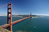
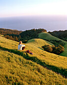
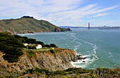
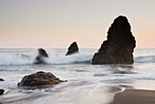
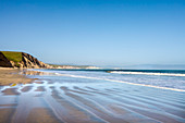
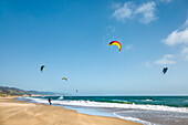
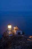
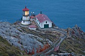
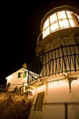
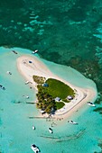
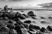
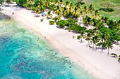
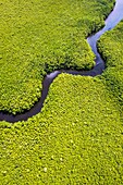
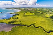
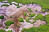
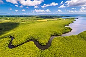
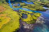
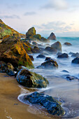
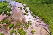
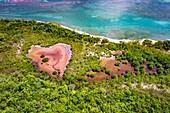
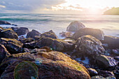
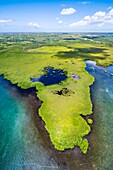
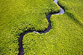
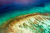
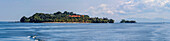
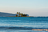
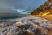
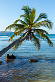
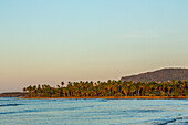
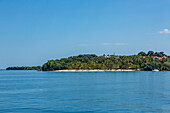
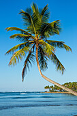
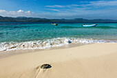
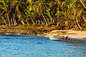
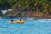
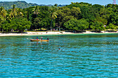
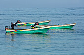
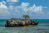
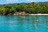
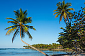
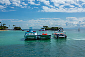
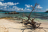
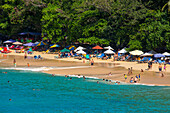
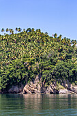
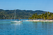
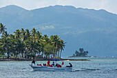
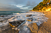
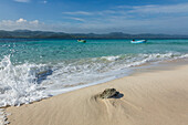
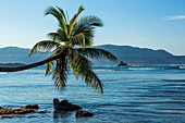
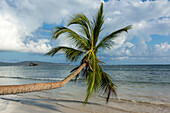
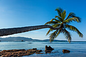
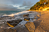
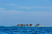
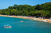
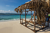
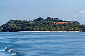
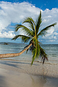
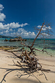
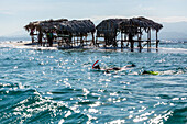
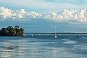
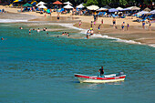
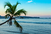
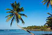
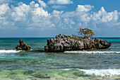
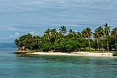
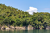
70076655 - Golden Gate Bridge, Marin headlands, San Francisco, California, USA70433439 - USA, California, Marin, woman sitting on a grassy hillside in the Marin Headlands looking towards the Pacific70351037 - View from Marin County on San Francisco, California, USA, America70138629 - Sunset over sea stacks at Rodeo Cove, Golden Gate NRA, Marin Headlands, San Francisco, California, USA71175565 - Drakes Bay, Point Reyes National Seashore, Marin County, California, USA71175567 - Kite surfer, Drakes Bay, Point Reyes National Seashore, Marin County, California, USA71175566 - Stop sign on the beach, Point Reyes National Seashore, Marin County, California, USA70326129 - USA, California, Marin County, Point Reyes National Seashore, old lighthouse on the left, modern light on the right, perched on point of Point Reyes Conglomerate rock, staircase for visitors, dusk, vertical70326128 - USA, California, Marin County, Point Reyes National Seashore, old lighthouse on the left, modern light on the right, perched on a point of Point Reyes conglomerate rock with red lichen, staircase and resting platform for visitors, dusk70326130 - USA, California, Marin County, Point Reyes National Seashore, old lighthouse perched on point of Point Reyes Conglomerate rock, amateur photographers taking pictures, night, vertical71166149 - France, Guadeloupe Island, Sainte Rose, Grand cul de sac marin, Caret islet71412573 - Muir Beach Dusk, Marin County, California, USA13937805 - France, Caribbean, Lesser Antilles, Guadeloupe, Grand Cul-de-Sac Marin, heart of the Guadeloupe National Park, Grande-Terre, Port-Louis, aerial view of the Souffleur beach\n13933197 - France, Caribbean, Lesser Antilles, Guadeloupe, Grand Cul-de-Sac Marin, heart of the Guadeloupe National Park, Grande-Terre, Port-Louis, aerial view of the Gris-Gris Cove\n13929872 - France, Caribbean, Lesser Antilles, Guadeloupe, Grand Cul-de-Sac Marin, heart of the Guadeloupe National Park, Grande-Terre, Morne-à-l'Eau, Canal Cove, aerial view on the widest mangrove belt of the Lesser Antilles, Biosphere Reserve of Guadeloupe, here the Canal des Rotours, dug over nearly 6 km at the beginning of the 19th century (1826-1830) by hand of Men, slaves, to allow the drainage of the plain\n13937747 - France, Caribbean, Lesser Antilles, Guadeloupe, Grand Cul-de-Sac Marin, heart of the Guadeloupe National Park, Grande-Terre, Port-Louis, aerial view of the Gris-Gris Cove\n13933770 - France, Caribbean, Lesser Antilles, Guadeloupe, Grand Cul-de-Sac Marin, heart of the Guadeloupe National Park, Grande-Terre, Morne-à-l'Eau, Canal Cove, aerial view on the widest mangrove belt of the Lesser Antilles, Biosphere Reserve of Guadeloupe, here the Canal des Rotours, dug over nearly 6 km at the beginning of the 19th century (1826-1830) by hand of Men, slaves, to allow the drainage of the plain\n13934472 - France, Caribbean, Lesser Antilles, Guadeloupe, Grand Cul-de-Sac Marin, heart of the Guadeloupe National Park, Grande-Terre, Vieux-Bourg, aerial view of the largest mangrove belt in the Lesser Antilles, Biosphere Reserve of Guadeloupe\n13931919 - France, Caribbean, Lesser Antilles, Guadeloupe, Grand Cul-de-Sac marin, heart of Guadeloupe national park, Grande-Terre, Morne-à-l'Eau, Canal cove, aerial view on the wider mangrove belt of the Lesser Antilles, Guadeloupe Biosphere Reserve, here the Canal des Rotours, dug for nearly 6 km at the beginning of the 19th century (1826-1830) by hand of men, slaves, to allow drainage of the plain\n13930414 - France, Caribbean, Lesser Antilles, Guadeloupe, Grand Cul-de-Sac Marin, heart of the Guadeloupe National Park, Grande-Terre, Basse-Terre, Baie-Mahault, aerial view of the largest mangrove belt in the Lesser Antilles, Guadeloupe Biosphere Reserve, here the Strait of the Salty River\n71415417 - Muir Beach Dusk, Marin County, California, USA71415416 - Muir Beach Dusk, Marin County, California, USA13937026 - France, Caribbean, Lesser Antilles, Guadeloupe, Grand Cul-de-Sac Marin, heart of the Guadeloupe National Park, Grande-Terre, Vieux-Bourg, aerial view of the largest mangrove belt in the Lesser Antilles, Biosphere Reserve of Guadeloupe\n13932175 - France, Caribbean, Lesser Antilles, Guadeloupe, Grand Cul-de-Sac Marin, heart of the Guadeloupe National Park, aerial view of the Gris-Gris Cove, its heart-shaped marsh in the mangrove of the Gaschet River, the beach and the lagoon\n71415418 - Sunset on Muir Beach, Marin County, California, USA13935986 - France, Caribbean, Lesser Antilles, Guadeloupe, Grand Cul-de-Sac Marin, heart of the Guadeloupe National Park, Grande-Terre, Morne-à-l'Eau, Canal Cove, aerial view on the widest mangrove belt of the Lesser Antilles, Guadeloupe Biosphere Reserve\n13934368 - France, Caribbean, Lesser Antilles, Guadeloupe, Grand Cul-de-Sac Marin, heart of the Guadeloupe National Park, Grande-Terre, Morne-à-l'Eau, Canal Cove, aerial view on the widest mangrove belt of the Lesser Antilles, Biosphere Reserve of Guadeloupe, here the Canal des Rotours, dug over nearly 6 km at the beginning of the 19th century (1826-1830) by hand of Men, slaves, to allow the drainage of the plain\n13930929 - France, Caribbean, Lesser Antilles, Guadeloupe, Grand Cul-de-Sac Marin, heart of the Guadeloupe National Park, Basse-Terre, aerial view of the coral reef of the Fajou Islet, the longest coral reef (25 km) of the Lesser Antilles, Biosphere Reserve of the Archipelago of Guadeloupe\n13936314 - France, Caribbean, Lesser Antilles, Guadeloupe, Grand Cul-de-Sac Marin, heart of the Guadeloupe National Park, aerial view of the largest mangrove belt in the Lesser Antilles, Guadeloupe Biosphere Reserve, Pointe-à-Pitre and the La Soufrière volcano chain in the background\n13933711 - France, Caribbean, Lesser Antilles, Guadeloupe, Grand Cul-de-Sac Marin, heart of the Guadeloupe National Park, Basse-Terre, aerial view of the Fajou Islet and the longest coral reef (25 km) of the Lesser Antilles, Biosphere Reserve of the Archipelago of Guadeloupe\n13932010 - France, the Caribbean, Lesser Antilles, Guadeloupe, Grande-Terre, Le Gosier, panoramic aerial view of the Islet of Gosier and the Petit Cul-de-Sac Marin\n13930095 - France, Caribbean, Lesser Antilles, Guadeloupe, Grand Cul-de-Sac Marin, heart of the Guadeloupe National Park, Grande-Terre, Basse-Terre, Baie-Mahault, aerial view of the largest mangrove belt in the Lesser Antilles, Guadeloupe Biosphere Reserve, here the Strait of the Salty River\n13929824 - France, Caribbean, Lesser Antilles, Guadeloupe, Grand Cul-de-Sac Marin, heart of the Guadeloupe National Park, Basse-Terre, aerial view of the Fajou Islet and the longest coral reef (25 km) of the Lesser Antilles, Biosphere Reserve of the Archipelago of Guadeloupe\n70433516 - USA, California, a landscape of the Marin Headlands enshrouded in fog , B&W71175564 - Wild flowers in the dunes, Point Reyes National Seashore, Marin County, California, USA70381918 - San Francisco, California, Golden Gate Bride from Marin Headlands, USA70545460 - Sunset at the Marin Headlands70516369 - The Golden Gate Bride, seen from the Marin Headlands, San Francisco, California.70146368 - Mother and daughter in field of colorful wildflowers on hillside in spring, Bolinas Ridge, Marin County, California70146369 - Field of purple wildflowers in green grass field on hillside at sunset, Bolinas Ridge, Mount Tamalpais, Marin County, California70138522 - Trail through Muir Woods National Monument. Marin County. California. USA14126176 - Waves break over tiny Cayo Arena or Paradise Island, a sandbar island on the northwest coast of the Dominican Republic. At high tide, it is completely submerged under a few inches of water.14126089 - Cayo Levantado, a resort island in the Bay of Samana in the Dominican Republic.14126078 - Coconut palm trees on a small island in the Bahia de Las Galeras on the Samana Peninsula, Dominican Republic.14125513 - Waves breaking on the rocks at sunrise on a beach near Barahona, Dominican Republic. A slow shutter speed gives the water a blurred look.14125212 - A curved coconut palm over the beach at Bahia de Las Galeras on the Samana Peninsula, Dominican Republic.14125153 - Coconut palm trees line the shore at Bahia de Las Galeras on the Samana Peninsula, Dominican Republic.14125086 - Cayo Vigia is connected to the town of Samana by a pedestrian bridge called Brug Samana van Leona. Dominican Republic.14124440 - A sailboat & tourists on the beach of Cayo Levantado, a resort island in the Bay of Samana in the Dominican Republic.14124148 - A curved coconut palm over the beach at Bahia de Las Galeras on the Samana Peninsula, Dominican Republic.14124147 - Motor launches are moored in the clear shallow water around Cayo Arena or Paradise Island. Behind is Monte Cristi National Park in the Dominican Republic., Hispaniola.14124100 - Two fishermen prepare to launch their boat in the early morning in the Bay of Samana, near Samana, Dominican Republic. Palm trees line the shore.14123950 - Two fishermen in their small boat in the Bay of Samana, near Samana, Dominican Republic. Palm trees line the shore.14123912 - Fishermen off the coast of Cayo Levantado, a resort island in the Bay of Samana in the Dominican Republic.14123415 - Motor launches are moored in the clear shallow water around Cayo Arena or Paradise Island. Behind is Monte Cristi National Park in the Dominican Republic., Hispaniola.14123310 - Guides move a shelter on tiny Paradise Island, a small sandbar island on the northwest coast of the Dominican Republic. At high tide, it is completely submerged under a few inches of water.14126066 - A guide prepares his boat to go to Paradise Island, a small island in the coral reef off the shore of the Dominican Republic.14125543 - A seagrape tree growing on a limestone islet surrounded by crystal-clear water in Rincon Bay. Dominican Republic.14124527 - Fishermen off the coast of Cayo Levantado, a resort island in the Bay of Samana in the Dominican Republic.14124317 - A curved coconut palm over the beach at Bahia de Las Galeras on the Samana Peninsula, Dominican Republic.14124248 - Tour boats off the coast of Cayo Levantado, a resort island in the Bay of Samana in the Dominican Republic.14123928 - A dead tree on Rincon Beach with limestone islet with a seagrape tree behind. Dominican Republic.14123670 - Tourists on the beach on Sosua Bay in the Dominican Republic.14092259 - Local people in Purus river in Amazon on sunny summer day with trees on river bank, near Iquitos, Loreto, Peru. Navigating one of the tributaries of the Amazon to Iquitos about 40 kilometers near the town of Indiana.14126431 - A dead tree on Rincon Beach with limestone islet with a seagrape tree behind. Dominican Republic.14126370 - Limestone cliffs & palm groves on the shore of the Bay of Samana in the Dominican Republic.14125784 - A sailboat & tourists on the beach of Cayo Levantado, a resort island in the Bay of Samana in the Dominican Republic.14125551 - A boatload of tourists return from an ocean excursion at Bahia de Las Galeras on the Samana Peninsula, Dominican Republic.14125327 - Waves breaking on the rocks at sunrise on a beach near Barahona, Dominican Republic. A slow shutter speed gives the water a blurred look.14124828 - Motor launches are moored in the clear shallow water around Cayo Arena or Paradise Island. Behind is Monte Cristi National Park in the Dominican Republic., Hispaniola.14124768 - A curved coconut palm over the beach at Bahia de Las Galeras on the Samana Peninsula, Dominican Republic.14124759 - A curved coconut palm over the beach at Bahia de Las Galeras on the Samana Peninsula, Dominican Republic.14124717 - A curved coconut palm over the beach at Bahia de Las Galeras on the Samana Peninsula, Dominican Republic.14124651 - Waves breaking on the rocks at sunrise on a beach near Barahona, Dominican Republic. A slow shutter speed gives the water a blurred look.14124267 - Tourists on the tiny Paradise Island off the northwest coast of the Dominican Republic. It is a good snorkeling location.14124130 - Tourists on the beach on Sosua Bay in the Dominican Republic.14123602 - A thatched-roofed shelter on Cayo Arena or Paradise Island. In the background is Monte Cristi National Park in the Dominican Republic., Hispaniola.14123368 - Cayo Levantado, a resort island in the Bay of Samana in the Dominican Republic.14126526 - Coconut palm trees on a small island in the Bahia de Las Galeras on the Samana Peninsula, Dominican Republic.14126442 - Crashing waves on the limestone coral shore near Samana, Dominican Republic. Palm trees line the shore.14126357 - Small limestone island with a seagrape tree and a Great Blue Heron in the Bay of Samana in the Dominican Republic.14126214 - A motor launch is moored in the clear shallow water around Cayo Arena or Paradise Island. In the background is Monte Cristi National Park in the Dominican Republic., Hispaniola.14126205 - Coconut palms & a seagrape tree on Rincon Beach on the north coast of the Samana Peninsula in the Dominican Republic.14125842 - A curved coconut palm over the beach at Bahia de Las Galeras on the Samana Peninsula, Dominican Republic.14125427 - A dead tree on Rincon Beach with limestone islet with a seagrape tree behind. Dominican Republic.14125135 - A curved coconut palm over the beach at Bahia de Las Galeras on the Samana Peninsula, Dominican Republic.14125023 - Tourists snorket as waves break over tiny Paradise Island, a small sandbar island on the northwest coast of the Dominican Republic. At high tide, it is completely submerged under a few inches of water.14125011 - A sailboat & the Brug Samana van Leona pedestrian bridge connecting Cayo Vigia to Samana in the Dominican Republic.14124580 - A seagrape tree growing on a limestone islet surrounded by crystal-clear water in Rincon Bay. Dominican Republic.14124160 - A small tourist excursion boat at Bahia de Las Galeras on the Samana Peninsula, Dominican Republic.14124090 - Limestone cliffs & palm groves on the shore of the Bay of Samana in the Dominican Republic.14123922 - Tourists on the beach of Cayo Levantado, a resort island in the Bay of Samana in the Dominican Republic.14123598 - Tourists on the beach on Sosua Bay in the Dominican Republic.14123320 - A curved coconut palm over the beach at Bahia de Las Galeras on the Samana Peninsula, Dominican Republic.14126067 - A curved coconut palm over the beach at Bahia de Las Galeras on the Samana Peninsula, Dominican Republic.14125893 - Palm trees on Cayo Levantado, a resort island in the Bay of Samana in the Dominican Republic.14124812 - A seagrape tree growing on a limestone islet surrounded by crystal-clear water in Rincon Bay. Dominican Republic.14124771 - Palm trees on Cayo Levantado, a resort island in the Bay of Samana in the Dominican Republic.14123878 - Limestone cliffs & palm groves on the shore of the Bay of Samana in the Dominican Republic.page suivante