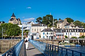
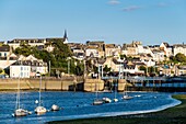
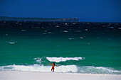
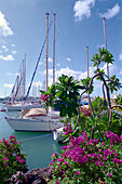
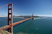
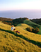
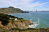
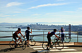
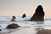
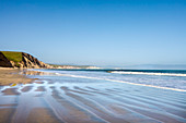
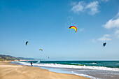
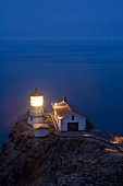
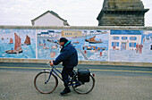
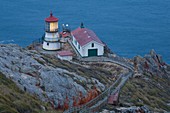
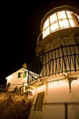
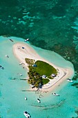
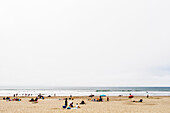
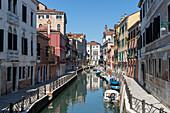
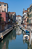
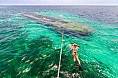
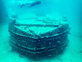
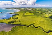
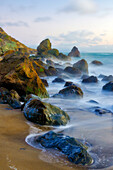
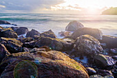
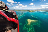
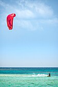
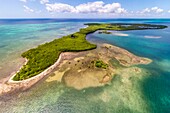
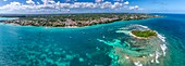
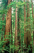
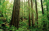
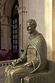
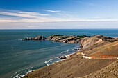
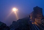
13935377 - France, Finistere, Douarnenez, Port-Rhu, Jean Marin footbridge\n13931822 - France, Finistere, Douarnenez, Port-Rhu, Jean Marin footbridge\n13928804 - France, Caribbean, Lesser Antilles, Guadeloupe, Grande-Terre, Le Gosier, Pointe de la Verdure, preparation of a hydro-ulm at the end of the day, in the Petit Cul-de-Sac Marin\n70012645 - A woman wearing a bikini running into the surge, Hyams Beach, Jervis Bay Marin Park, New South Wales, Australia70005372 - Boats at the marina under clouded sky, Le Marin, Martinique, Caribbean, America70076655 - Golden Gate Bridge, Marin headlands, San Francisco, California, USA70433439 - USA, California, Marin, woman sitting on a grassy hillside in the Marin Headlands looking towards the Pacific70005371 - View at the marina under blue sky, Le Marin, Martinique, Caribbean, America70351037 - View from Marin County on San Francisco, California, USA, America70351036 - Cyclists looking from Marin County onto San Francisco, California, USA, America70433415 - USA, California, woman hiking with the Pacific in background, Marin Headlands70138629 - Sunset over sea stacks at Rodeo Cove, Golden Gate NRA, Marin Headlands, San Francisco, California, USA71175565 - Drakes Bay, Point Reyes National Seashore, Marin County, California, USA71175567 - Kite surfer, Drakes Bay, Point Reyes National Seashore, Marin County, California, USA71175566 - Stop sign on the beach, Point Reyes National Seashore, Marin County, California, USA70326129 - USA, California, Marin County, Point Reyes National Seashore, old lighthouse on the left, modern light on the right, perched on point of Point Reyes Conglomerate rock, staircase for visitors, dusk, vertical70138545 - Waves washing on shore. Rodeo Beach. Golden Gate National Recreation Area. Marin County. California. USA70107074 - Retired marin cycling by a road with a mural painting wall and Eckmül lighthouse in background. Penmarc h. Finistere. Brittany. France70326128 - USA, California, Marin County, Point Reyes National Seashore, old lighthouse on the left, modern light on the right, perched on a point of Point Reyes conglomerate rock with red lichen, staircase and resting platform for visitors, dusk70326130 - USA, California, Marin County, Point Reyes National Seashore, old lighthouse perched on point of Point Reyes Conglomerate rock, amateur photographers taking pictures, night, vertical70138630 - Sunset over sea stacks at Rodeo Cove, Golden Gate NRA, Marin Headlands, San Francisco, California, USA70138546 - Bird rock. Rodeo Beach. Golden Gate National Recreation Area. Marin County. California. USA70138543 - Sea stacks at twilight. Rodeo Beach. Golden Gate National Recreation Area. Marin County. California. USA71150877 - Alcatraz Island in the bay of San Francisco, Marin County, California, USA71166149 - France, Guadeloupe Island, Sainte Rose, Grand cul de sac marin, Caret islet71210231 - People on Stinson Beach. Stinson Beach is an unincorporated community, a census-designated place, near Muir Woods and Mount Tamalpais in the Golden Gate National Recreation Area which is located in Marin County, California.71431251 - Rio Marin. Venice, Veneto, Italy71431252 - Rio Marin. Venice, Veneto, Italy71422401 - Muir Woods National Monument, Marin County, California, USA71422400 - Muir Woods National Monument, Marin County, California, USA71412577 - Beach, Coastal Marin Headlands, California, USA71412573 - Muir Beach Dusk, Marin County, California, USA13937805 - France, Caribbean, Lesser Antilles, Guadeloupe, Grand Cul-de-Sac Marin, heart of the Guadeloupe National Park, Grande-Terre, Port-Louis, aerial view of the Souffleur beach\n13933197 - France, Caribbean, Lesser Antilles, Guadeloupe, Grand Cul-de-Sac Marin, heart of the Guadeloupe National Park, Grande-Terre, Port-Louis, aerial view of the Gris-Gris Cove\n13929872 - France, Caribbean, Lesser Antilles, Guadeloupe, Grand Cul-de-Sac Marin, heart of the Guadeloupe National Park, Grande-Terre, Morne-à-l'Eau, Canal Cove, aerial view on the widest mangrove belt of the Lesser Antilles, Biosphere Reserve of Guadeloupe, here the Canal des Rotours, dug over nearly 6 km at the beginning of the 19th century (1826-1830) by hand of Men, slaves, to allow the drainage of the plain\n13929729 - France, the Caribbean, the Lesser Antilles, Guadeloupe, Grand Cul-de-Sac Marin, the heart of the Guadeloupe National Park, snorkeling on a wreck colonized by corals\n13929687 - France, the Caribbean, the Lesser Antilles, Guadeloupe, Grand Cul-de-Sac Marin, the heart of the Guadeloupe National Park, snorkeling on a wreck colonized by corals, underwater view\n13937747 - France, Caribbean, Lesser Antilles, Guadeloupe, Grand Cul-de-Sac Marin, heart of the Guadeloupe National Park, Grande-Terre, Port-Louis, aerial view of the Gris-Gris Cove\n13937647 - France, Caribbean, Lesser Antilles, Guadeloupe, Grand Cul-de-Sac Marin, heart of the Guadeloupe National Park, cabotage on Caret Islet\n13933770 - France, Caribbean, Lesser Antilles, Guadeloupe, Grand Cul-de-Sac Marin, heart of the Guadeloupe National Park, Grande-Terre, Morne-à-l'Eau, Canal Cove, aerial view on the widest mangrove belt of the Lesser Antilles, Biosphere Reserve of Guadeloupe, here the Canal des Rotours, dug over nearly 6 km at the beginning of the 19th century (1826-1830) by hand of Men, slaves, to allow the drainage of the plain\n13931834 - France, the Caribbean, the Lesser Antilles, Guadeloupe, Grand Cul-de-Sac Marin, the heart of the Guadeloupe National Park, snorkeling on a wreck colonized by corals\n13934472 - France, Caribbean, Lesser Antilles, Guadeloupe, Grand Cul-de-Sac Marin, heart of the Guadeloupe National Park, Grande-Terre, Vieux-Bourg, aerial view of the largest mangrove belt in the Lesser Antilles, Biosphere Reserve of Guadeloupe\n13931919 - France, Caribbean, Lesser Antilles, Guadeloupe, Grand Cul-de-Sac marin, heart of Guadeloupe national park, Grande-Terre, Morne-à-l'Eau, Canal cove, aerial view on the wider mangrove belt of the Lesser Antilles, Guadeloupe Biosphere Reserve, here the Canal des Rotours, dug for nearly 6 km at the beginning of the 19th century (1826-1830) by hand of men, slaves, to allow drainage of the plain\n13930414 - France, Caribbean, Lesser Antilles, Guadeloupe, Grand Cul-de-Sac Marin, heart of the Guadeloupe National Park, Grande-Terre, Basse-Terre, Baie-Mahault, aerial view of the largest mangrove belt in the Lesser Antilles, Guadeloupe Biosphere Reserve, here the Strait of the Salty River\n71415417 - Muir Beach Dusk, Marin County, California, USA71415416 - Muir Beach Dusk, Marin County, California, USA13937026 - France, Caribbean, Lesser Antilles, Guadeloupe, Grand Cul-de-Sac Marin, heart of the Guadeloupe National Park, Grande-Terre, Vieux-Bourg, aerial view of the largest mangrove belt in the Lesser Antilles, Biosphere Reserve of Guadeloupe\n13936551 - France, the Caribbean, the Lesser Antilles, Guadeloupe, Grand Cul-de-Sac Marin, the heart of the Guadeloupe National Park, snorkeling in the lagoon around the Fajou Islet, here a Giant Caribbean Anemone (Condylactis gigantea), underwater view\n13932175 - France, Caribbean, Lesser Antilles, Guadeloupe, Grand Cul-de-Sac Marin, heart of the Guadeloupe National Park, aerial view of the Gris-Gris Cove, its heart-shaped marsh in the mangrove of the Gaschet River, the beach and the lagoon\n71415418 - Sunset on Muir Beach, Marin County, California, USA13935986 - France, Caribbean, Lesser Antilles, Guadeloupe, Grand Cul-de-Sac Marin, heart of the Guadeloupe National Park, Grande-Terre, Morne-à-l'Eau, Canal Cove, aerial view on the widest mangrove belt of the Lesser Antilles, Guadeloupe Biosphere Reserve\n13934368 - France, Caribbean, Lesser Antilles, Guadeloupe, Grand Cul-de-Sac Marin, heart of the Guadeloupe National Park, Grande-Terre, Morne-à-l'Eau, Canal Cove, aerial view on the widest mangrove belt of the Lesser Antilles, Biosphere Reserve of Guadeloupe, here the Canal des Rotours, dug over nearly 6 km at the beginning of the 19th century (1826-1830) by hand of Men, slaves, to allow the drainage of the plain\n13930929 - France, Caribbean, Lesser Antilles, Guadeloupe, Grand Cul-de-Sac Marin, heart of the Guadeloupe National Park, Basse-Terre, aerial view of the coral reef of the Fajou Islet, the longest coral reef (25 km) of the Lesser Antilles, Biosphere Reserve of the Archipelago of Guadeloupe\n13937040 - France, Caribbean, Lesser Antilles, Guadeloupe, Grand Cul-de-Sac Marin, heart of the Guadeloupe National Park, cabotage on Caret Islet\n13936314 - France, Caribbean, Lesser Antilles, Guadeloupe, Grand Cul-de-Sac Marin, heart of the Guadeloupe National Park, aerial view of the largest mangrove belt in the Lesser Antilles, Guadeloupe Biosphere Reserve, Pointe-à-Pitre and the La Soufrière volcano chain in the background\n13935282 - France, Caribbean, Lesser Antilles, Guadeloupe, Grand Cul-de-Sac Marin, heart of the Guadeloupe National Park, Kite surf around Caret Islet\n13933711 - France, Caribbean, Lesser Antilles, Guadeloupe, Grand Cul-de-Sac Marin, heart of the Guadeloupe National Park, Basse-Terre, aerial view of the Fajou Islet and the longest coral reef (25 km) of the Lesser Antilles, Biosphere Reserve of the Archipelago of Guadeloupe\n13932010 - France, the Caribbean, Lesser Antilles, Guadeloupe, Grande-Terre, Le Gosier, panoramic aerial view of the Islet of Gosier and the Petit Cul-de-Sac Marin\n13930095 - France, Caribbean, Lesser Antilles, Guadeloupe, Grand Cul-de-Sac Marin, heart of the Guadeloupe National Park, Grande-Terre, Basse-Terre, Baie-Mahault, aerial view of the largest mangrove belt in the Lesser Antilles, Guadeloupe Biosphere Reserve, here the Strait of the Salty River\n13929824 - France, Caribbean, Lesser Antilles, Guadeloupe, Grand Cul-de-Sac Marin, heart of the Guadeloupe National Park, Basse-Terre, aerial view of the Fajou Islet and the longest coral reef (25 km) of the Lesser Antilles, Biosphere Reserve of the Archipelago of Guadeloupe\n13709439 - Rodriguez Marin square, Alcala de Henares, Madrid Province, Spain, Europe70433418 - USA, San Francisco, an aerial view of a container ship passing under the Golden Gate Bridge, a view towards the Marin Headlands, Tiburon and Angel Island70433502 - USA, California, woman hiking in the Marin Headlands with San Francisco in the distance10294964 - Panoramic view of Rhine, Great St. Marin and Cologne Cathedral at night in Cologne71324506 - View of the Golden Gate Bridge from the Marin Headlands, San Francisco, California, USA70433412 - USA, California, woman hiking in the Marin Headlands70433516 - USA, California, a landscape of the Marin Headlands enshrouded in fog , B&W70452546 - USA, California, Golden Gate Bridge sunrise from Marin County, San Francisco70433414 - USA, California, close-up of a happy young woman backpacking, Marin Headlands71198715 - USA, California, San Francisco, NOPA, Fort Point, Chrissy Fields, The Golden Gate Bridge at dusk looking towards the Marin Headlands71175564 - Wild flowers in the dunes, Point Reyes National Seashore, Marin County, California, USA70382748 - USA, California, San Francisco Bay Area, Marin Headlands, Golden Gate National Recreation Area, Muir Beach Overlook, view of the Pacific Ocean70382747 - USA, California, San Francisco Bay Area, Marin Headlands, Golden Gate National Recreation Area, Muir Beach Overlook70382743 - USA, California, San Francisco Bay Area, Marin Headlands, Golden Gate National Recreation Area, Point Bonita, morning70382746 - USA, California, San Francisco Bay Area, Marin Headlands, Golden Gate National Recreation Area, Muir Beach Overlook70381918 - San Francisco, California, Golden Gate Bride from Marin Headlands, USA70300191 - USA, California, San Francisco, Golden Gate Bridge, Monterey cypress Cupressus macrocarpa trees, looking north toward Marin County, dusk, NR70248907 - A weathered wall of a decommissioned artillary battery overlooking the Pacific Ocean at Marin Headlands near San Francisco, California, USA70138552 - Bracket fungus on a fallen log. Muir Woods National Monument. Marin County. California. USA71319200 - The Golden Gate Bridge, linking the city of San Francisco with Marin County, taken from Baker Beach at sunset and high tide, San Francisco, California, United States of America, North America70545460 - Sunset at the Marin Headlands70382745 - USA, California, San Francisco Bay Area, Marin Headlands, Golden Gate National Recreation Area, Muir Beach Overlook70239903 - Sea bass with emulsion of olive oil at restaurant Allo e Aceite by chef Pablo Romero, Marin. Pontevedra province, Galicia, Spain71319577 - Golden Gate Bridge glowing at sunset with the San Francisco skyline behind, viewed from the Marin Headlands, San Francisco, California, United States of America, North America70516369 - The Golden Gate Bride, seen from the Marin Headlands, San Francisco, California.70382755 - USA, California, San Francisco, Marin Headlands, Golden Gate National Recreation Area, Golden Gate Bridge, dawn70193240 - Bride by Golden Gate Bridge. Marin County, California, USA70146368 - Mother and daughter in field of colorful wildflowers on hillside in spring, Bolinas Ridge, Marin County, California70138544 - Fort Cronkhite. Rodeo Beach. Golden Gate National Recreation Area. Marin County. California. USA70138523 - Redwoods in dappled sunlight. Muir Woods National Monument. Marin County. California. USA70138519 - Redwood trunks. Muir Woodds National Monument. Marin County. California. USA70146369 - Field of purple wildflowers in green grass field on hillside at sunset, Bolinas Ridge, Mount Tamalpais, Marin County, California70138553 - Tennessee Valley in early Spring. Golden Gate National Recreation Area. Marin County. California. USA70138524 - Tall redwood trees in Muir Woods National Monument. Marin County. California. USA70138522 - Trail through Muir Woods National Monument. Marin County. California. USA70138521 - Redwood (Sequoia sempervirens) forest. Muir Woods National Monument. Marin County. California. USA71035026 - Statue of Marin Drzic, Dubrovnik, Croatia, Europe70382744 - USA, California, San Francisco Bay Area, Marin Headlands, Golden Gate National Recreation Area, Point Bonita, morning70300192 - USA, California, Marin County, Point Reyes National Seashore, lighthouse and staircase in fog at dusk, person on stairspage suivante