Mountainous region Photos – License unique travel photos ❘ lookphotos
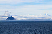
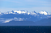
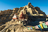
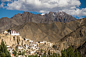
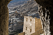
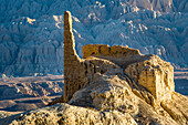
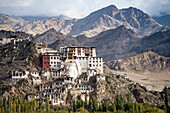
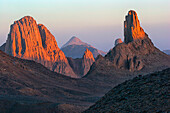
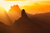
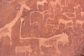
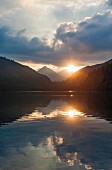
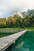
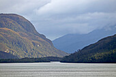
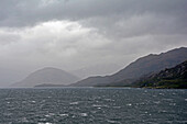
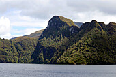
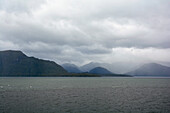
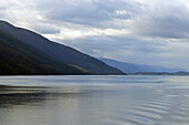
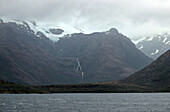
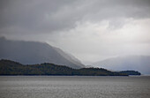
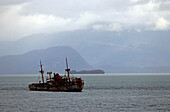
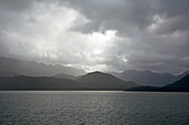
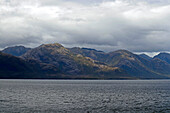
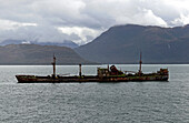
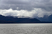
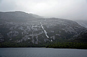
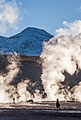
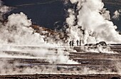
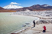
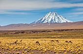
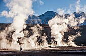
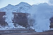
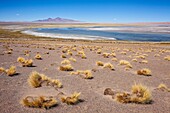
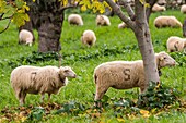
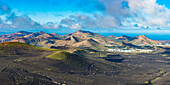
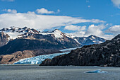
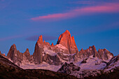
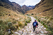
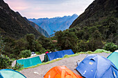
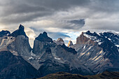
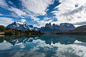
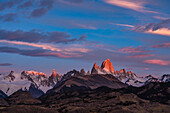
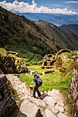
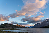
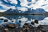
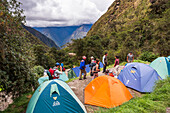
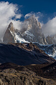
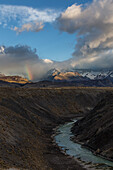
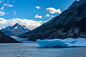
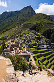
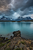
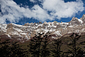
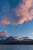
71447951 - Chile; Southern Chile; Los Lagos Region; Mountains of the southern Cordillera Patagonica; on the Navimag ferry through the Patagonian fjords; Gulf of Corcovado; mountainous coastline almost obscured by clouds; On the right in the background is the top of the Corcovado volcano71447953 - Chile; Southern Chile; Los Lagos Region; Mountains of the southern Cordillera Patagonica; on the Navimag ferry through the Patagonian fjords; Golfo de Ancud; mountainous coastline overlooking the Hornopiren National Park13884957 - Ruins of the Guge Kingdom with prayer flags in the mountainous landscape of the Sutlej Valley in the Himalayan Mountains; Tsaparang, Zanda, Tibetan Autonomous Region, Tibet13884846 - Thikse Monastery in a mountainous region in India; Ladakh, Jammu and Kashmir, India13884958 - View through rock walls of The Guge Kingdom Ruins in the mountainous landscape of the Sutlej Valley in the Himalayan Mountains; Tsaparang, Zanda, Tibetan Autonomous Region, Tibet13884956 - Ruins and limestone rock formations in the mountainous landscape around the Sutlej Valley near the Guge Kingdom with Himalayas in background; Tsaparang, Zanda, Tibetan Autonomous Region, Tibet13884847 - Thikse Monastery in a mountainous region in India; Ladakh, Jammu and Kashmir, India71416463 - Namibia; Karas region; Southern Namibia; Fish River Canyon; Canyon Nature Park West; mountainous landscape on the outer western edge; lonely quiver tree71416480 - Namibia; Southern Namibia; Hardap region; Namib Desert; mountainous landscape and grassy red sand dunes71416486 - Namibia; Hardap region; Central Namibia; Namib Desert; Namib Naukluft Park; mountainous desert landscape in the morning light71416468 - Namibia; Karas region; Southern Namibia; Canyon Nature Park West; mountainous landscape in the late afternoon light; barren gravel plain and mountains in the background71416465 - Namibia; Karas region; Southern Namibia; Fish River Canyon; Canyon Nature Park West; mountainous landscape in the reddish twilight; View from the outer west edge71360694 - Ethiopia; Southern Nations Region; barren, mountainous landscape in southwest Ethiopia; on the way from Turmi to Arbore71328487 - lush vegetation on the mountainous shores of Lago (Lake) Ranco, Region de los Lagos, Chile, South America70357701 - The Mountainous Region of Fjallabak, Which Encompasses the Landmannalaugar, in the South of the Country. the 47, 000 Hectares of the Fjallabak Were Classed As a Nature Reserve in 1979, Highlands of Iceland, Europe71441478 - Bavella mountains, stacked stones, thunderstorm, lightning, landscape, mountains, mountainous region, Corsica, France70161189 - Hikers in the mountainous region of Mount Sinai, Egypt, Africa71315576 - Bobolice Castle is a 14th-century royal castle in the village of Bobolice, Poland. The complex is located within a semi-mountainous highland region called the Polish Jura. Poland, Europe.70367507 - Senckenberg-Museum, Diorama with brown bear, Ursus arctos, mountainous region, typical habitat of the large mammal, Frankfurt am Main, Hesse, Germany, Europe71315577 - Bobolice Castle is a 14th-century royal castle in the village of Bobolice, Poland. The complex is located within a semi-mountainous highland region called the Polish Jura. Poland, Europe.70357730 - The Mountainous Region of Fjallabak, Which Encompasses the Landmannalaugar and Surrounding Areas, in the South of the Country. the 47, 000 Hectares of the Fjallabak Were Classed As a Nature Reserve in 1979, Highlands of Iceland, Europe70357736 - The Mountainous Region of Fjallabak, Which Encompasses the Landmannalaugar and Surrounding Areas, in the South of the Country. the 47, 000 Hectares of the Fjallabak Were Classed As a Nature Reserve in 1979, Highlands of Iceland, Europe70357732 - The Mountainous Region of Fjallabak, Which Encompasses the Landmannalaugar and Surrounding Areas, in the South of the Country. the 47, 000 Hectares of the Fjallabak Were Classed As a Nature Reserve in 1979, Highlands of Iceland, Europe70357735 - Transparent Drops of Water on Green Philonotis Fontana Moss, the Mountainous Region of Fjallabak, Which Encompasses the Landmannalaugar and Surrounding Areas, in the South of the Country. the 47, 000 Hectares of the Fjallabak Were Classed As a Nature Rese70357733 - The Mountainous Region of Fjallabak, Which Encompasses the Landmannalaugar and Surrounding Areas, in the South of the Country. the 47, 000 Hectares of the Fjallabak Were Classed As a Nature Reserve in 1979, Highlands of Iceland, Europe70354928 - TUNISIA, Chebika Region, Tamerza An oasis hid within the mountainous landscape surrounding the town70357731 - The Mountainous Region of Fjallabak, Which Encompasses the Landmannalaugar and Surrounding Areas, in the South of the Country. the 47, 000 Hectares of the Fjallabak Were Classed As a Nature Reserve in 1979, Highlands of Iceland, Europe70357969 - Green Philonotis Fontana Moss, Mountainous Region of Fjallabak, Which Encompasses the Landmannalaugar and Surrounding Areas, in the South of the Country. the 47, 000 Hectares of the Fjallabak Were Classed As a Nature Reserve in 1979, Highlands of Iceland,70357737 - The Mountainous Region of Fjallabak, Which Encompasses the Landmannalaugar and Surrounding Areas, in the South of the Country. the 47, 000 Hectares of the Fjallabak Were Classed As a Nature Reserve in 1979, Highlands of Iceland, Europe70357734 - The Mountainous Region of Fjallabak, Which Encompasses the Landmannalaugar and Surrounding Areas, in the South of the Country. the 47, 000 Hectares of the Fjallabak Were Classed As a Nature Reserve in 1979, Highlands of Iceland, Europe71076488 - The Hoggar Mountains (Arabic: ???? ?????, Berber: idurar n Ahaggar, Tuareg: Idurar Uhaggar), also known as the Ahaggar, are a highland region in the central Sahara, southern Algeria, along the Tropic of Cancer. This mountainous region is located about 1, 71076487 - The Hoggar Mountains (Arabic: ???? ?????, Berber: idurar n Ahaggar, Tuareg: Idurar Uhaggar), also known as the Ahaggar, are a highland region in the central Sahara, southern Algeria, along the Tropic of Cancer. This mountainous region is located about 1, 71076489 - The Hoggar Mountains (Arabic: ???? ?????, Berber: idurar n Ahaggar, Tuareg: Idurar Uhaggar), also known as the Ahaggar, are a highland region in the central Sahara, southern Algeria, along the Tropic of Cancer. This mountainous region is located about 1, 70382224 - Germany, Ramsau bei Berchtesgaden. Germany, Ramsau bei Berchtesgaden, Biosphaerenreservat Berchtesgadener Land, Berchtesgaden National Park, Berchtesgadener Land, Berchtesgaden Alps, Upper Bavaria, Bavaria, D-Ramsau-Taubensee, mountainous landscape, Alps 70382229 - Germany, Friedewald Hessen, Herfabach, Seulingswald, Fulda-Werra-Bergland, Hessisches Bergland, Hessian mountainous country, Rhoen, Vordere Rhoen, Kuppenrhoen, Hesse, moated castle, castle ruin, castle moat, ditch. Germany, Friedewald Hessen, Herfabach, S70382230 - Germany, Friedewald Hessen. Germany, Friedewald Hessen, Herfabach, Seulingswald, Fulda-Werra-Bergland, Hessisches Bergland, Hessian mountainous country, Rhoen, Vordere Rhoen, Kuppenrhoen, Hesse, D-Friedewald-Lautenhausen, biosphere reserve Rhoen, farmhous11328082 - A prehistoric cave drawing in Twyfelfontein in Damaraland in the Kunene Region in Namibia12358890 - Sunset at the Alpsee lake near Schwangau in the Allgäu region of Germany70205248 - Hacienda in the mountainous country north of Medellin, Columbia, South America12358889 - The outdoor pool at the Alpsee lake near Schwangau in the Allgäu region of Germany71447945 - Chile; Southern Chile; Magallanes Region; Mountains of the southern Cordillera Patagonica; on the Navimag ferry through the Patagonian fjords; Canal Messier; Rays of sunshine break through the rain clouds71447940 - Chile; Southern Chile; Magallanes Region; Mountains of the southern Cordillera Patagonica; on the Navimag ferry through the Patagonian fjords; Angostura Inglesa or English Narrows; low hanging rain clouds; Rain and sun alternate71447937 - Chile; Southern Chile; Magallanes Region; Mountains of the southern Cordillera Patagonica; on the Navimag ferry through the Patagonian fjords; Angostura Inglesa; Sun and clouds alternate; View of the forested mountain slopes71447935 - Chile; Southern Chile; Magallanes Region; Mountains of the southern Cordillera Patagonica; on the Navimag ferry through the Patagonian fjords; Channel Union71428566 - Nyons, Drôme department, Rhône-Alpes region, Provence, France71447946 - Chile; Southern Chile; Aysen Region; Mountains of the southern Cordillera Patagonica; on the Navimag ferry through the Patagonian fjords; Canal Messier; forested cliffs and steep mountain slopes71447941 - Chile; Southern Chile; Aysen region; Mountains of the southern Cordillera Patagonica; on the Navimag ferry through the Patagonian fjords; Canal Messier; low-hanging rain clouds and blue sky alternate71447938 - Chile; Southern Chile; Magallanes Region; Mountains of the southern Cordillera Patagonica; on the Navimag ferry through the Patagonian fjords; Angostura Inglesa; Clouds over the mountain slopes71447934 - Chile; Southern Chile; Magallanes region; Mountains of the southern Cordillera Patagonica; Canal Union; View of the foothills of the glaciers of Campo de Hielo Sur71436677 - Holidaymakers on Sant Elm beach, Serra Tramontana region, Mallorca, Spain71447950 - Chile; Southern Chile; Aysen region; Mountains of the southern Cordillera Patagonica; on the Navimag ferry through the Patagonian fjords; Mountain landscape between Canal Polluche and Puerto Aguirre71447942 - Chile; Southern Chile; Magallanes Region; Mountains of the southern Cordillera Patagonica; on the Navimag ferry through the Patagonian fjords; Shoal Bajo Cotopaxi; Shipwreck of the "Capitan Leonidas"71447939 - Chile; Southern Chile; Magallanes Region; Mountains of the southern Cordillera Patagonica; on the Navimag ferry through the Patagonian fjords; Angostura Inglesa or English Narrows; low hanging rain clouds; Rain71436681 - Island of Sa Dragonera in backlight, seen from Punta de Sa Galera near Sant Elm, Serra Tramuntana region, Mallorca, Spain71447947 - Chile; Southern Chile; Aysen region; Mountains of the southern Cordillera Patagonica; on the Navimag ferry through the Patagonian fjords; Canal Messier; Rain clouds over the mountain landscape71447943 - Chile; Southern Chile; Magallanes region; Mountains of the southern Cordillera Patagonica; on the Navimag ferry through the Patagonian fjords; Bajo Cotopaxi; Shipwreck of the "Capitan Leonidas"71436679 - Panoramic restaurant in the bay of Sant Elm, Tramuntana region, Mallorca, Spain71447944 - Chile; Southern Chile; Magallanes Region; Mountains of the southern Cordillera Patagonica; on the Navimag ferry through the Patagonian fjords; Canal Messier; Rays of sunshine break through the rain clouds71447936 - Chile; Southern Chile; Magallanes Region; Mountains of the southern Cordillera Patagonica; on the Navimag ferry through the Patagonian fjords; Canal Concepcion; low hanging rain clouds; Rain71100095 - El Tatio geysers, Atacama desert. Region de Antofagasta. Chile.71100099 - Salar (salt flats) or laguna (lagoon) de Tuyaito, also called Tuyajito, Altiplano, Puna, Atacama desert. Region de Antofagasta. Chile.71100097 - El Tatio geysers, Atacama desert. Region de Antofagasta. Chile.71100861 - Salar (salt flats) or laguna (lagoon) de Talar, also called de Aguas Calientes, Altiplano, Puna, Atacama desert. Region de Antofagasta. Chile.71100100 - Vicuñas (Vicugna vicugna), in Altiplano, Puna, in background Andes Mountains, Road to Argentina by Paso Sico, near Socaire, Atacama desert. Region de Antofagasta. Chile.71100096 - El Tatio geysers, Atacama desert. Region de Antofagasta. Chile.71100094 - El Tatio geysers, Atacama desert. Region de Antofagasta. Chile.71100092 - The heaven, from Valle de la Luna (Valley of the Moon ) near San Pedro de Atacama, and salt deposited on the ground, Atacama desert. Region de Antofagasta. Chile.70886414 - View for Ozieri town and comune in province of Sassari, northern Sardinia, Italy, in the Logudoro historical region, Ozieri is the centre of the earliest known archaeological culture on Sardinia known as Ozieri Culture,in center statue of Jezus Christ on 71100091 - Valle de la Luna (Valley of the Moon ), in background at left volcanoes Licancabur and Juriques with snow on top, and salt deposited on the nearest mountains, Atacama desert. Region de Antofagasta. Chile.71100098 - Salar de Tara, Altiplano, Puna, Atacama desert. Region de Antofagasta. Chile.71197662 - Sheep grazing, Alqueria d Avall, Bunyola, region of the Serra de Tramuntana, Mallorca, Spain.71436077 - Sunrise panorama from Montana de Guardilama to the La Geria wine region, with the towns of Uga and Yaiza behind, Lanzarote, Canary Islands, Spain, Europe13849129 - The Cordon de los Condores forms the east side of the valley of the Rio de las Vueltas north of Los Glaciares National Park, near El Chalten, Argentina, in the Patagonia region of South America.13848819 - The Grey Glacier and Lago Grey in Torres del Paine National Park, a UNESCO World Biosphere Reserve in Chile in the Patagonia region of South America.13848707 - The Fitz Roy Massif in pastel pre-dawn morning twilight. Los Glaciares National Park near El Chalten, Argentina. A UNESCO World Heritage Site in the Patagonia region of South America. Mount Fitz Roy is in the tallest peak in the center.13848675 - Hiking down from Dead Womans Pass 5,200m summit, Inca Trail Trek day 2, Cusco Region, Peru13848525 - Campsite at sunrise on morning of day 3 of Inca Trail Trek, Cusco Region, Peru13847984 - One small spot of sunset light illuminates Torre Central behind the Cuernos and Monte Almirante Nieto in the Paine Massif in Torres del Paine National Park, a UNESCO World Biosphere Reserve in Chile in the Patagonia region of South America.13847692 - Early morning reflections of the Paine Massif in Lago Pehoe in Torres del Paine National Park, a UNESCO World Biosphere Reserve in Chile in the Patagonia region of South America.13847657 - First light at sunrise on the Fitz Roy Massif with light on Mount Fitz Roy and Cerro Torre. Los Glaciares National Park near El Chalten, Argentina. A UNESCO World Heritage Site in the Patagonia region of South America.13847653 - Phuyupatamarca Inca ruins on Inca Trail Trek day 3, Cusco Region, Peru13847145 - The moon and colorful sunrise clouds over Lago Grey in Torres del Paine National Park, a UNESCO World Biosphere Reserve in Chile in the Patagonia region of South America.13847024 - Early morning reflections of the Paine Massif in Lago Pehoe in Torres del Paine National Park, a UNESCO World Biosphere Reserve in Chile in the Patagonia region of South America.13846882 - Inca Trail Trek day 2 campsite, Cusco Region, Peru13846727 - Mount Fitz Roy in Los Glaciares National Park near El Chalten, Argentina. A UNESCO World Heritage Site in the Patagonia region of South America. Because of the prevailing weather patterns over the Southern Patagonian Ice Field, Mount Fitz Roy often makes its own clouds, usually obscuring the peak. It is completely visible only about 5 days per month.13846557 - Clouds obscure the Fitz Roy Massif in Los Glaciares National Park near El Chalten, Argentina. A UNESCO World Heritage Site in the Patagonia region of South America. In the foreground is the canyon of the Rio de las Vueltas.13846139 - The Grey Glacier and Lago Grey in Torres del Paine National Park, a UNESCO World Biosphere Reserve in Chile in the Patagonia region of South America.13846041 - Machu Picchu Inca ruins, Cusco Region, Peru13845953 - The rocky shoreline of Lago Pehoe in Torres del Paine National Park, a UNESCO World Biosphere Reserve in Chile in the Patagonia region of South America. Across the lake is the Paine Massif in the low clouds.13844550 - The Cordon de los Condores forms the east side of the valley of the Rio de las Vueltas north of Los Glaciares National Park, near El Chalten, Argentina, in the Patagonia region of South America. In the foreground are lenga or Southern Beech Trees.13849030 - Sunrise light on the clouds over the Paine Massif in Torres del Paine National Park, a UNESCO World Biosphere Reserve in Chile in the Patagonia region of South America.13848307 - Sunlight on the Piedras Blancas Glacier at the base of Cerro Electrico in Los Glaciares National Park near El Chalten, Argentina. A UNESCO World Heritage Site in the Patagonia region of South America.13847515 - The Grey Glacier and Lago Grey in Torres del Paine National Park, a UNESCO World Biosphere Reserve in Chile in the Patagonia region of South America.13847476 - Grey Glacier and Lago Grey in Torres del Paine National Park, a UNESCO World Biosphere Reserve in Chile in the Patagonia region of South America.13847416 - Hiking into Winaywayna Inca Ruins on Inca Trail Trek day 3, Cusco Region, Peru13847324 - Campervan at Te Mata Peak at sunrise at Hastings near Napier, Hawkes Bay Region, North Island, New Zealand13846789 - Tourists sightseeing at Machu Picchu Inca Ruins, Cusco Region, Peru13845488 - Lago Capri in Los Glaciares National Park near El Chalten, Argentina. A UNESCO World Heritage Site in the Patagonia region of South America. The lake is surrounding by a Lenga forest. Across the lake is Mount Fitz Roy and the Fitz Roy Massif.13844945 - Inca Trail, hikers on day 1 of the trek, Cusco Region, Perunext page