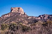
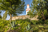
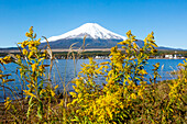
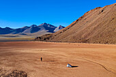
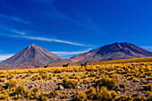
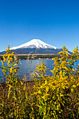
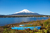
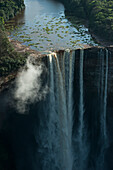
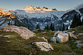
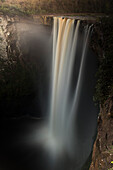
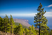
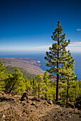
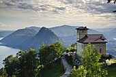
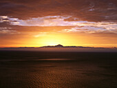
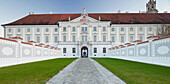
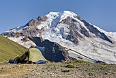
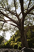
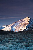
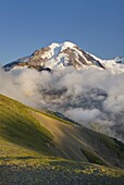
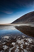
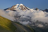
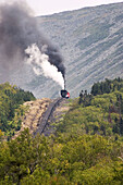
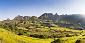
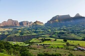
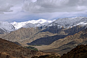
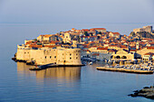
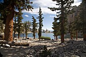
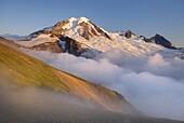
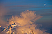
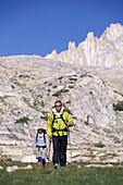
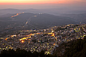
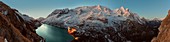
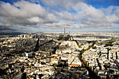
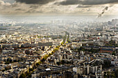
14125426 - Casa Grande Peak in the Chisos Mountains of Big Bend National Park, Texas, has an elevation of 7,325 feet.71450643 - Summit cross on the Jungfernberg, 18 meters above sea level and highest elevation in the Lieper Winkel, Lieper Winkel on Usedom, Baltic Sea coast, Mecklenburg-Western Pomerania, Germany * Baumallee, with cobblestones on Usedom, Baltic Sea coast, Mecklenburg-Western Pomerania, Germany 71450642 - Summit cross on the Jungfernberg, 18 meters above sea level and highest elevation in the Lieper Winkel, Lieper Winkel on Usedom, Baltic Sea coast, Mecklenburg-Western Pomerania, Germany * Baumallee, with cobblestones on Usedom, Baltic Sea coast, Mecklenburg-Western Pomerania, Germany 13846528 - Inca Trail map of elevation of distance, Cusco Region, Peru71434796 - White tower of Bad Homburg Castle in front of the elevation seen from the castle park, Taunus, Hesse, Germany13884372 - Mount Fuji, as viewed from Lake Yamanakako (Lake Yamanaka), which is the largest of the Fuji Five Lakes and has the third-highest elevation of any lake in Japan. It is also the closest of the five to Mount Fuji; Yamanakako, Yamanashi Prefecture, Japan13883517 - A woman walking back to her tent in a dry lake bed at 15,000 feet elevation in the Atacama desert.13883288 - Llama walking through tall grass growing at 14,000 feet elevation in the Atacama Desert.13884373 - Mount Fuji, as viewed from Lake Yamanakako (Lake Yamanaka), which is the largest of the Fuji Five Lakes and has the third-highest elevation of any lake in Japan. It is also the closest of the five to Mount Fuji; Yamanakako, Yamanashi Prefecture, Japan13884371 - Mount Fuji, as viewed from Lake Yamanakako (Lake Yamanaka), which is the largest of the Fuji Five Lakes and has the third-highest elevation of any lake in Japan. It is also the closest of the five to Mount Fuji; Yamanakako, Yamanashi Prefecture, Japan71412479 - Kaieteur Falls Guyana, South America, Kaieteur Falls is the world's widest single drop waterfall, located on the Potaro River in the Kaieteur National Park, in Essequibo, Guyana, Height: 741m Elevation: 1,581m Number of drops: 1 Longest drop: 741m, Watercourse: Potaro River71411530 - Mount Challenger elevation: 8236 feet / 2510 meter, North Cascades National Park71412480 - Kaieteur Falls Guyana, South America, Kaieteur Falls is the world's widest single drop waterfall, located on the Potaro River in the Kaieteur National Park, in Essequibo, Guyana, Height: 741m Elevation: 1,581m Number of drops: 1 Longest drop: 741m, Watercourse: Potaro River71415258 - Spain, Canary Islands, El Hierro Island, Malpaso Mountain, elevation 1503 meters, elevated view of the south coast71415259 - Spain, Canary Islands, El Hierro Island, Malpaso Mountain, elevation 1503 meters, elevated view of the south coast13997271 - Back view of Priest with chasuble at Eucharist celebration,Sunday Mass,Elevation of the Host,St. Nicholas Cathedral,Dalat,Vietnam,Indochina,Southeast Asia,Asia13997317 - Catholic Mass,Eucharist celebration,Elevation of the Host,Saint Maurice Church,Cruseilles,Haute-Savoie,France,Europe70519953 - 'A building at high elevation overlooking the mountains and lakes; Lugano, Ticino, Switzerland'70061327 - Overview from steep coast of Gran Canaria's Tamadaba Natural Park, Atlantic Ocean with Island of Tenerife and 3718m high Mount Teide at sunset, highest elevation in The Atlantic Ocean, El Teide, Tenerife, Canary Islands, Atlantic Ocean, Spain70369272 - East elevation of Herzogenburg Priory, Herzogenburg, Lower Austria, Austria, Europe70308064 - Alpine camp on Chowder Ridge with Mount Baker elevation 10,778 feet 3,285 m in the distance Mount Baker Wilderness Washington USA70246806 - The landscape of Ladakh, also called a alpine desert lies on a elevation of about 3500 m There is hardly any vegetation and summers are short and dry70408886 - Fig Tree near the escarpment of the Simien Mountains close to the Simien Mts National Park near the village of Mekarebya at an elevation of about 2100m during the end of the rainy season The Simien Semien, Saemen, Simen Mountains National Park is part o70403756 - USA, California, Eastern Sierra Nevada Area, Alta Vista, Sierra Nevada Mountains, view of Mt Tom, elevation 13,652 feet, sunrise70308061 - Clouds dissipating in the evening light around Mount Baker elevation 10,778 feet 3,285 m Seen from Chowder Ridge, Mount Baker Wilderness Washington USA70308060 - Clouds dissipating in the evening around Mount Baker elevation 10,778 feet 3,285 m Seen from Chowder Ridge, Mount Baker Wilderness Washington USA70239731 - Views of the old city of Dubrovnik from an elevation position71063640 - Eucharistic liturgy, Elevation of the Host, France70403740 - USA, California, Death Valley National Park, Badwater, elevation 282 feet below sea level, lowest point in the Western Hemisphere, morning70308059 - Clouds dissipating in the evening around Mount Baker elevation 10,778 feet 3,285 m Seen from Chowder Ridge, Mount Baker Wilderness Washington USA70150349 - Coal fired steam engine powering the Cog Railway to the summit (elevation 6,288 ft) of Mt. Washington, White Mountains of New Hampshire, USA70146343 - Elevation marker sign and rolling green hills and oak trees in spring, Mount Diablo State Park, California71111822 - Sunrise over Mount Robson, highest mountain in the Canadian Rockies, elevation 3,954Â m (12,972Â ft), seen from Mumm Basin, Mount Robson Provincial Park British Columbia.71096259 - Bulgaria, Central Mountains, Troyan, Troyan Pass, elevation 1525 meters, Soviet-era, Battle Monument.70408885 - Panorama of a landscape near the escarpment of the Simien Mountains close to the Simien Mts National Park near the village of Mekarebya at an elevation of about 2300m during the end of the rainy season This area is heavily used for farming especially th70408884 - Panorama of a landscape near the escarpment of the Simien Mountains close to the Simien Mts National Park near the village of Mekarebya at an elevation of about 2300m during the end of the rainy season This area is heavily used for farming especially th70408882 - Landscape near the escarpment of the Simien Mountains close to the Simien Mts National Park near the village of Mekarebya at an elevation of about 2300m during the end of the rainy season This area is heavily used for farming especially the cultivation.70403738 - USA, California, Death Valley National Park, Badwater, elevation 282 feet below sea level, lowest point in the Western Hemisphere, sunset70246835 - The landscape of Ladakh, also called a alpine desert lies on a elevation of about 3500 m There is hardly any vegetation and summers are short and dry70239734 - Views of the old city of Dubrovnik from an elevation position70408887 - Field with Tef te ef, teff - local grain used to make a flatbread called injera near the escarpment of the Simien Mountains close to the Simien Mts National Park near the village of Mekarebya at an elevation of about 2300m during the end of the rainy sea70323542 - Argentina, Jujuy Province, Salinas Grande salt pan, elevation 3350 meters, 525 sq kms70308063 - Clouds dissipating in the evening light around Mount Baker elevation 10,778 feet 3,285 m Seen from Chowder Ridge, Mount Baker Wilderness Washington USA70408883 - Landscape near the escarpment of the Simien Mountains close to the Simien Mts National Park near the village of Mekarebya at an elevation of about 2300m during the end of the rainy season This area is heavily used for farming especially the cultivation.70384477 - Mount Teide or, in Spanish, Pico del Teide Teide Peak, is the highest elevation in Spain and the islands of the Atlantic it is the third largest volcano in the world from its base, after Mauna Loa and Mauna Kea located in Hawaii It is an active volcano w70344316 - Church of the Elevation of the Cross 1687-1692 in Vologda Kremlin, Vologda, Vologda region, Russia70311615 - Inyo National Forest, California - Lone Pine Lake at approximately 9900 feet elevation on Mt Whitney in the Sierra Nevada range Mt Whitney is the highest mountain in the continental United States Copyright Jim West70308062 - Clouds dissipating in the evening light around Mount Baker elevation 10,778 feet 3,285 m Seen from Chowder Ridge, Mount Baker Wilderness Washington USA71029447 - A storm brewing over Mount Hunter, as seen from 14.000 feet camp on Mount McKinley, also know as Denali, Alaska. Mount McKinley, (native name Denali) is the highest mountain peak in North America, with a summit elevation of 20,321 feet (6,194 m) above70501648 - Dan Duane leads the way through an alpine meadow while backpacking with Tom Purcell on the Sierra High Route, a 195 mile trackless path almost entirely between 9,000 and 11,500 feet in elevation in the Eastern Sierra Nevada mountains in California.70522360 - A woman in her thirties carrying an infant hikes in the high-elevation volcanic Haleakala crater, with ropy pahoehoe lava in the foreground.70501646 - Dan Duane enjoying a hot drink in his sleeping bag while on a backpacking trip on the Sierra High Route, a 195 mile trackless path almost entirely between 9,000 and 11,500 feet in elevation in the Eastern Sierra Nevada mountains in California.71107214 - Cotopaxi is a volcano of Ecuador Located in Canton Latacunga in Cotopaxi Province With an elevation of 5897msnm is the second most height of the country (being preceded by the Chimborazo) and one of the highest active volcanoes in the world (the highest a71057386 - A nomadic grazing camp near Gyama at 5200 meters elevation, inhabited by 'Changpas' (the nomadic migratory shepherds of Tibetan origin who use the land for grazing yaks, sheep, goats, and horses), Ladakh, India.70501647 - Dan Duane enjoying a hot drink in his sleeping bag while on a backpacking trip on the Sierra High Route, a 195 mile trackless path almost entirely between 9,000 and 11,500 feet in elevation in the Eastern Sierra Nevada mountains in California.70500391 - Cazorla, Spain. Cazorla lies at an elevation of 836 metres on the western slope of the Sierra de Cazorla. It is the entry point and base for visits to the Natural Park of Sierras de Cazorla Segura y las Villas, a vast protected area of magnificent river g70462343 - Mountaineers at 22, 400ft on the upper Canaleta near the summit of Aconcagua, at around 6800 meters elevation currently, Andes Mountain, Argentina, Mendoza, Andes Mountains, Argentina71150963 - Complete overview of the Marmolada 3, 343 m from Punta Serauta the Gran Vernel at both ends, In the central part Punta Ombretta, Punta Rocca e Punta Pen+¼a, the latter the greater elevation of the entire massif71183560 - Photograph of mountain climber showing smart watch with summit elevation, Chilliwack, British Columbia, Canada71210185 - High elevation view of Paris cityscape.71210184 - High elevation view of Paris cityscape.71210186 - High elevation view of Paris cityscape.